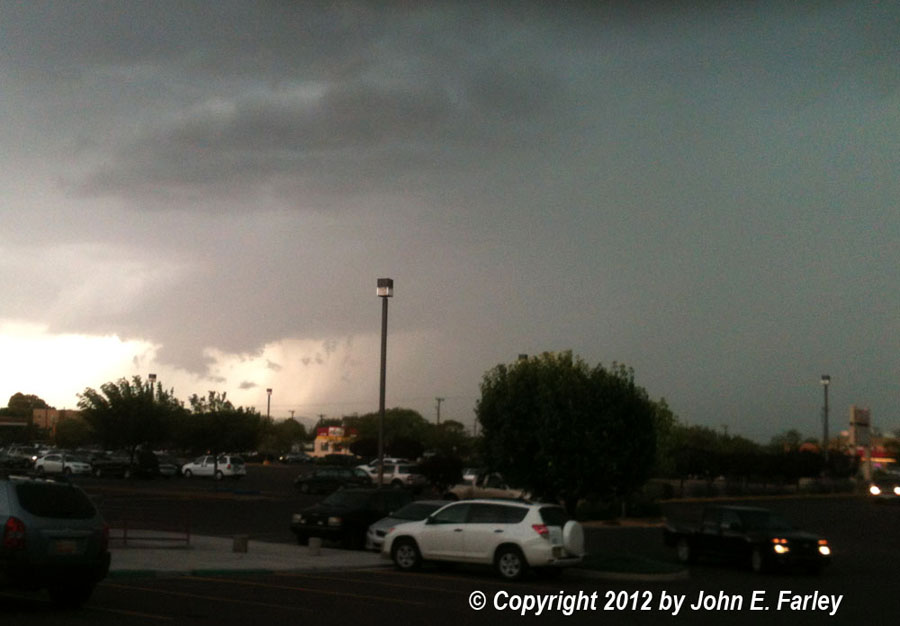
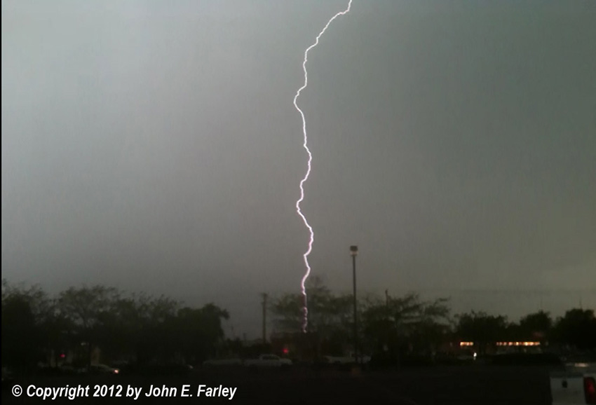
This is about as close to a supercell-type structure as you ever see west of the central mountains in New Mexico. This cell produced a radar-indicated 3 inches of rain northwest of Santa Fe, and almost certainly some fairly copious hail in localized areas. As it moved into Santa Fe, it produced an intense barrage of cloud-to-ground lightning in Santa Fe:
This, however, was pretty much the last hurrah for this cell, as its inflow was cut off by a new stronger storm just to its southwest. The new cell quickly became the storm of the day, getting the first of three severe thunderstorm warnings as it dumped large quantities of hail and torrential rain on I-25 at La Bajada Hill. TV news video from this area showed the ground completely covered by hail with the freeway's median turned into a river. As the storm continued south, it produced multiple reports of 60 mph wind, flash flooding, and at least golfball sized hail, with some media reports indicating tennis ball to softball sized hail in the Edgewood area, where there were also reports of accumulations of up to a foot of hail, necessitating the use of a snowplow. The most serious consequence of the storm was the shutdown of the commuter rail line between Albuquerque and Santa Fe, when a bridge was overtopped by three inches by floodwater. One train made it through at 2 mph, but after that the tracks were deemed unsafe, and the line remained closed the following day for inspections and emergency repairs.
Here are some links to various media reports on the storm:
KOB News 4 story on flooded commuter rail line
Slideshow of flooding and hail on the Santo Domingo (Kewa) Pueblo, from News 4
Article on hail damage around Edgewood, from KRQE-TV
Article on the flooded rail line and video of the flood, from the Santa Fe New Mexican
Here are some local storm reports from the Albuquerque NWS:
.TIME...   ...EVENT...      ...CITY LOCATION...     ...LAT.LON     .DATE...   ....MAG....      ..COUNTY LOCATION..ST.. ...SOURCE.
..REMARKS..

0827 PM     FLASH FLOOD      SANDIA PUEBLO           35.26N 106.57W  08/16/2012                   SANDOVAL           NM   LAW ENFORCEMENT
FLASH FLOODING ON ROUTE 313 WHERE IT CROSSES SANDIA WASH

0636 PM     TSTM WND DMG     6 N EDGEWOOD            35.15N 106.19W  08/16/2012                   SANTA FE           NM   NWS EMPLOYEE
7 INCH DIAMETER TREE KNOCKED DOWN.

0636 PM     HAIL             6 N EDGEWOOD            35.15N 106.19W  08/16/2012  E1.75 INCH       SANTA FE           NM   NWS EMPLOYEE
CORRECTION...GOLFBALL SIZED HAIL STONES OBSERVED

0820 PM     FLASH FLOOD      1 N SANDIA PUEBLO       35.27N 106.57W  08/16/2012                   SANDOVAL           NM   EMERGENCY MNGR
WATER AND DEBRIS OVER NM313 NEAR SANDIA WASH.

0735 PM     FLASH FLOOD      6 N EDGEWOOD            35.14N 106.19W  08/16/2012                   SANTA FE           NM   NWS EMPLOYEE

0600 PM     FLASH FLOOD      PENA BLANCA             35.57N 106.34W  08/16/2012                   SANDOVAL           NM   LAW ENFORCEMENT
RAIL RUNNER TRAIN STUCK IN PENA BLANCA AROUND 6 PM BECAUSE PART OF THE TRACK WAS WASHED AWAY.

0636 PM     HAIL             6 N EDGEWOOD            35.15N 106.19W  08/16/2012  E4.50 INCH       SANTA FE           NM   NWS EMPLOYEE

0609 PM     HAIL             GOLDEN                  35.27N 106.21W  08/16/2012  E1.00 INCH       SANTA FE           NM   CO-OP OBSERVER

0535 PM     TSTM WND GST     MADRID                  35.41N 106.15W  08/16/2012  E60 MPH          SANTA FE           NM   PUBLIC

0535 PM     TSTM WND GST     SAN FELIPE PUEBLO       35.43N 106.45W  08/16/2012  E60 MPH          SANDOVAL           NM   PUBLIC
Return to 2012 Severe Weather Observation page