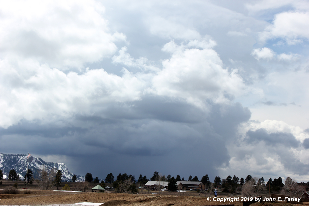
Around 2:30, while returning from the grocery store, I noticed a cumulonimbus cloud to the west, towering pretty high and with a knuckled anvil - signs of a strong updraft. I decided it was time to try for some thundersnow, and headed to a viewing spot at the west edge of the Pagosa Springs area. When I first got a good view of it, the cell looked pretty impressive, and was likely producing some heavy bursts of frozen precipitation somewhere near Chimney Rock National Monument:
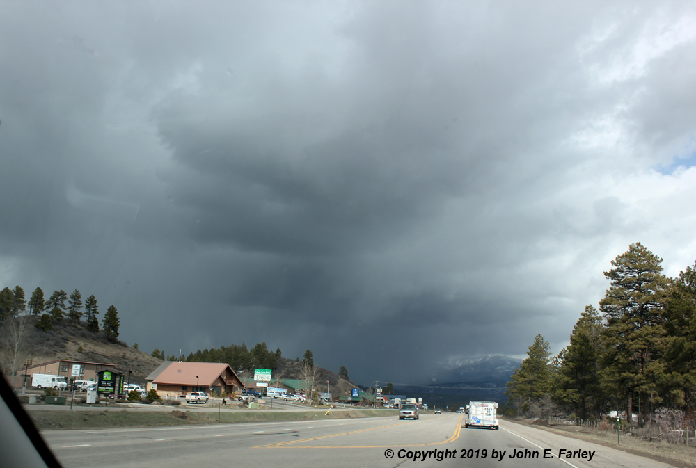
However, unlike convection earlier in the day which had been moving northeast, this cell was moving to the southeast, probably indicating it was just on the back side of the low pressure center. That motion would take it into a largely roadless area, so I gave up on it, but noticed that other strong cells were going up a little to the north of Pagosa Springs. These would cross U.S. 160 just to the northeast of town, so that seemed to be the way to go. As I went through town, I had this view of this activity ahead of me, a few miles northeast of town:
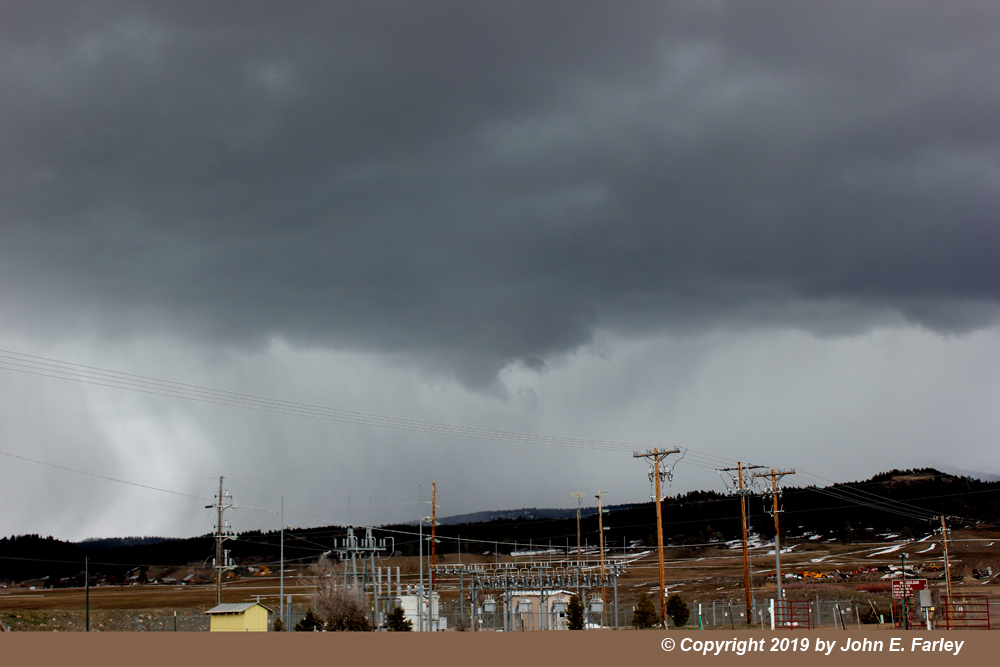
I intercepted this storm 5 or 6 miles northeast of Pagosa along U.S. 160. It produced a heavy burst of graupel/snow pellets that quickly covered the road, with even a little pea-sized hail mixed in. I moved a little farther up the road, and the first nearby flash of CG lightning occurred while I was driving. I stopped the next place I could and got out the video camera as graupel and some ordinary snow came down, and two more bolts of CG lighting hit a mile or so to my south or southeast. Unfortunately, though, I did not have the camera recording when I thought I did, so I do not have video of these. Fortunately, I later got a second chance to make up for this blunder. You don't always get that, so I am grateful. By now the storm was moving southeast into the roadless South San Juan Wilderness, so I went back to the fairgrounds just east of town to get pictures of the storm moving away and figure out what to do next. Here is a picture of the storm to my east from that location as it moved away:
There was even a slight lowering under the strongest part of the updraft that persisted for several minutes. However, the motion in this lowering appeared to be just upward, with no rotation. After this I went through some indecision, moving back and forth through town as new cells popped up in several locations. Kind of felt like whack-a-mole! But after a while I noticed new lightning strikes showing up a little west of town on the lightning tracker, so I headed back to near where I had started at the west edge of the Pagosa area. As I drove in that direction, I saw a couple flashes of lightning ahead of me, which gave me some encouragement. I stopped by the Vista Lake picnic shelter as graupel continued to fall intermittently. A heavy shower was to my northwest, with quite a bit of updraft more or less overhead and to the west. It seemed now like the storm motion was more NNW-to-SSE, with the area of convection gradually shifting to the south. I just took video for quite a while, making sure this time that the camera was recording. As with the first storm I had been in, the temperature on my car thermometer was 37 degreees, and it stayed there the entire time I was in this location. Earlier, as I had come through town between the storms, it had been in the mid-40s, but as soon as I got into the precipitation, it dropped back down and stayed there. As the snow pellets came down (and were mixed for a while with ordinary snow), I got a little rumble of thunder, then later a flash of in-cloud lightning overhead rather quickly followed by much louder thunder. As it was thundering, the pellets abruptly increased in size, to around pea-sized. They kept coming down and started to cover the ground, and then this:
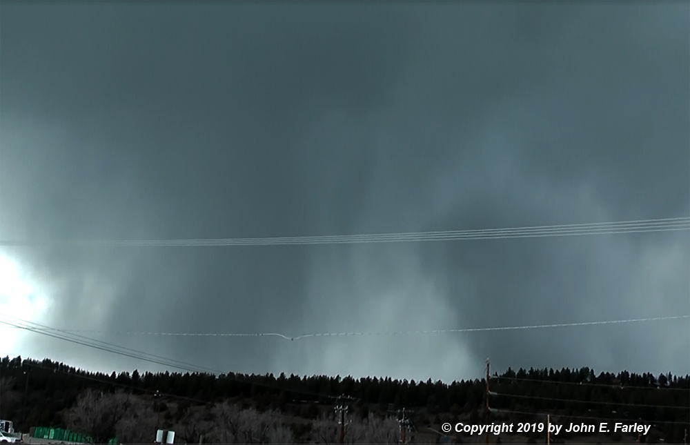
This bolt was less than a quarter mile from my location, and appears to have struck a tree - or perhaps struck the ground directly between me and the tree. Due to my closeness to this intense bolt my video was a bit blown out, and as often happens getting video of lightning, a rolling shutter issue allowed me to capture only part of the bolt on my video. However, if you look at this zoomed and enhanced video frame capture, you can see the bolt just to the right of the flagpole - and it appears to go right down the middle of a tree:
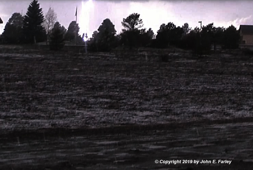
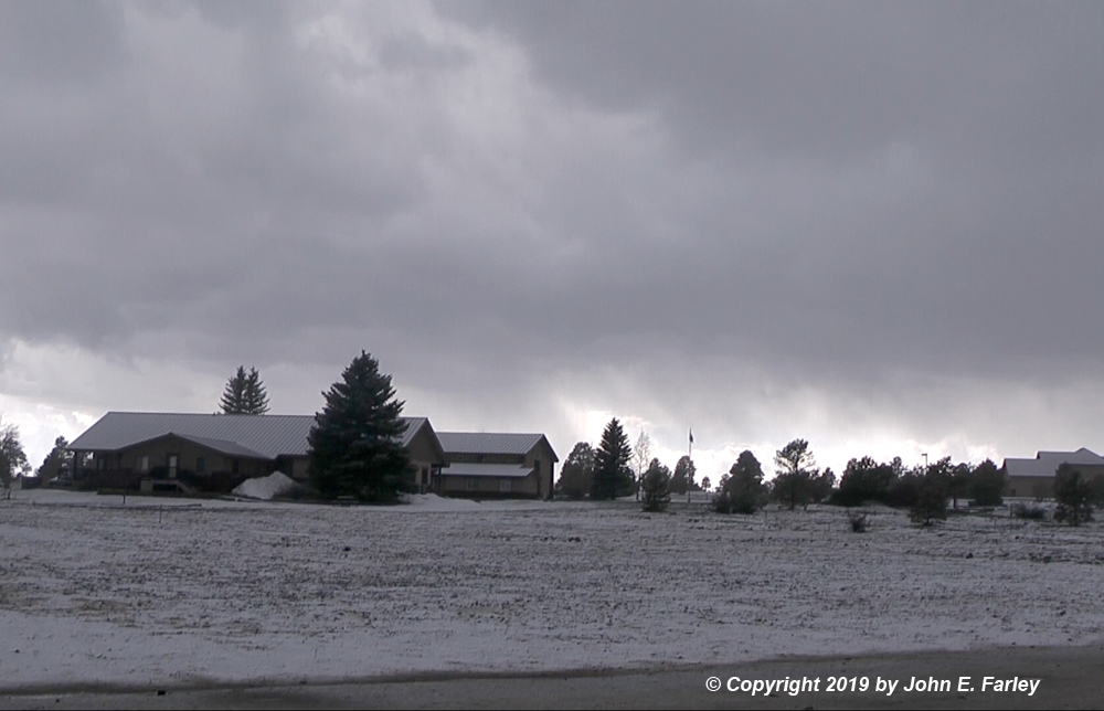
This is one of the closest lightning strikes I have ever captured with winter precipitation occurring, and frankly about as close as I WANT to capture when I have my car window open getting video. There had been no close CGs in the half hour or so before this one, and there were no more after it. The snow pellets kept coming down, though, and eventually accumulated to about a half inch on the hood of my car, just before I called the chase and headed home around 5:00 p.m. You can see the accumulation on the grassy areas and the roofs in this picture:
When I got home, there were a few more low rumbles of thunder as the precipitation lightened and briefly turned to rain, before one last burst of snow pellets came down. Then that was it for the Pagosa area, although radar would suggest some pretty substantial precipitation shifted south and southeast toward the Chama, NM area.
If you are interested, a somewhat longer video (a little over 2 minutes) with more thunder and some segments showing the accumulation of the graupel can be seen here:
Return to Winter Weather Observation page