For the third straight day, severe weather would be possible in New Mexico in association with the October, 2026 Four Corners Storm. This time, though, rather than the leading moisture surge from remnants of Hurricane Trudy, the main culprit would be the cut-off Pacific upper low to the west of that initial moisure surge. The original band of tropical moisture had pushed to the east of the central mountains of New Mexico, but now the upper low was slowly drifting eastward to take its place. However, wind profiles would remain similar to the last couple days, with an easterly component to the surface winds but with southwesterly flow higher up. This would continue to provide directional wind shear, favorable for storm rotation. And there was still plenty of Pacific moisture. However, the thinking was that with cooler temperatures the farther north you got in NM, the main severe threat would be near and south of I-25. In other words, more so for Albuquerque and points south than for Santa Fe. In Santa Fe, the temperature would remain in the 60s, cooler than farther south where it would reach the 70s, at least. Thus, less instability than farther south. When a severe thunderstorm watch was issued (which mentioned the possibility of a tornado or two), it did not include Santa Fe County - just the two counties to its immediate south and southward from there. This was unlike the previous two days, when Santa Fe was included in severe thunderstorm watches, albiet on the edges of both of those watches. But included. No severe weather occurred in the Santa Fe area on either of those days, though, although it did in other parts of New Mexico. Today, Santa Fe was not included in the watch, although the Storm Prediction Center (SPC) did have it in a marginal risk with a 2 percent chance of a tornado within a 25-mile radius. After all, there was plenty of moisture and plenty of shear, just not as much instability expected. Although I did keep one eye on the weather, I was more focused on a football game and an evening meetup for dinner with friends.
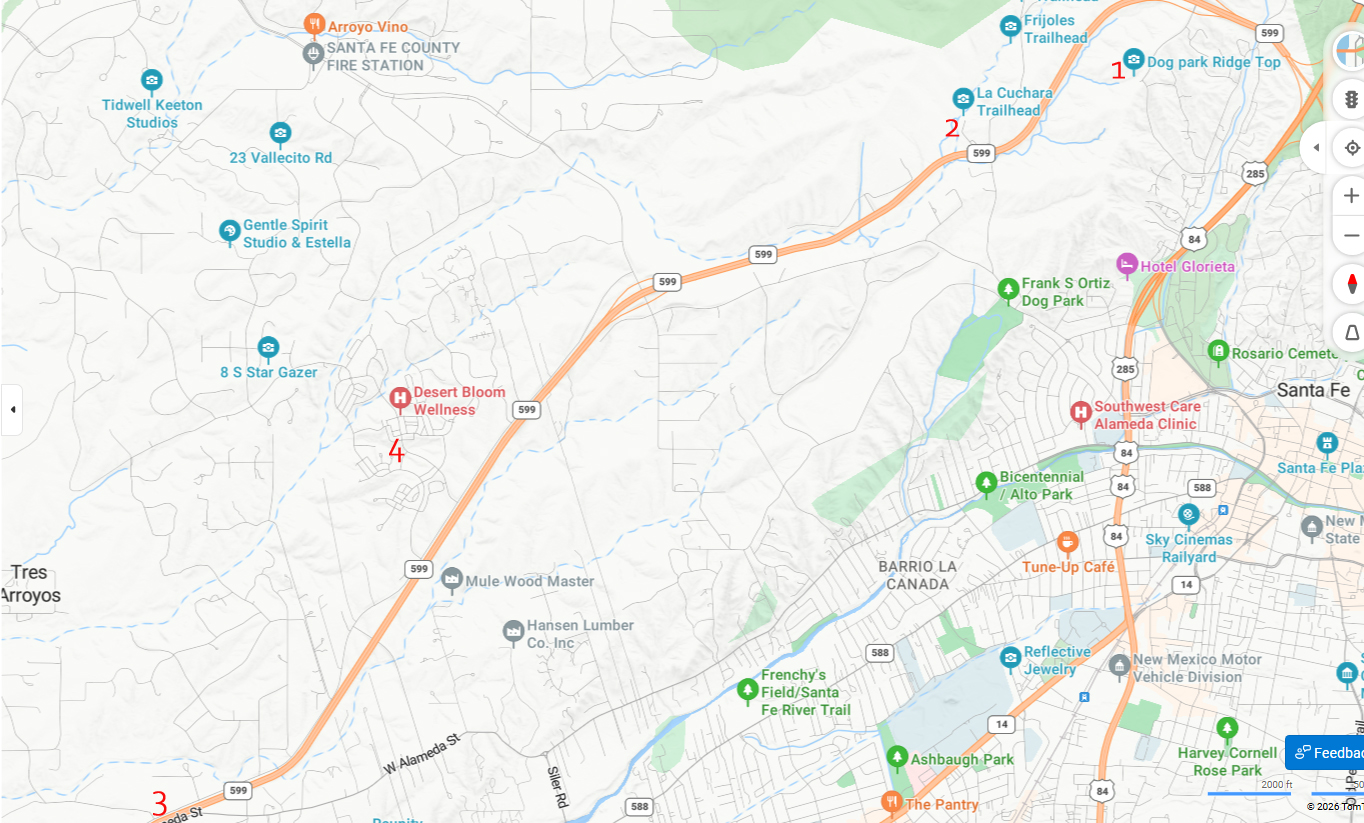
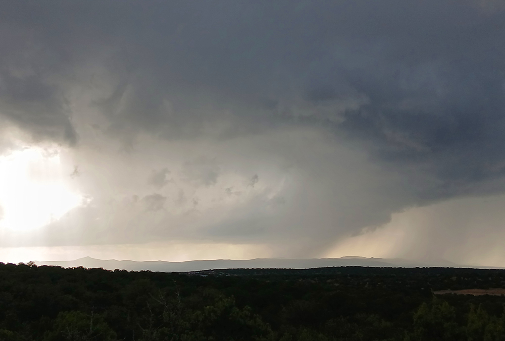
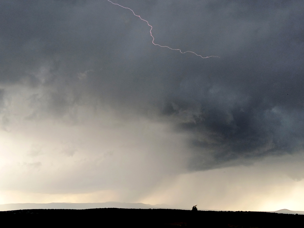
By around 4:15 p.m., the football game I had been watching was no longer close, and I had some time before we were scheduled to meet friends for dinner at the OG Pantry restaurant in Santa Fe. A broken line of strong storms was nearing Santa Fe. The line was aligned more or less north and south and the cells were moving north, somewhat training over the same areas, though perhaps with a slight eastward shift. So I decided to head out, try to find some spots northwest of town along Hwy 599, and see what I could see. I first stopped at Ridgetop Road, the first exit east of 84/285. Stop Number 1 on this map. There is a good viewpoint there, although it faces mostly to the west and northwest so I could not see what was going on down the line. There was a somewhat strong cell to the WNW, perhaps developing a little cloud-scale rotation. I got some pictures and even accidentally got a lightning bolt along the base of the clouds in one.
While I was at this spot, I became aware of a SVR warning for the next storm down the line, near Cerrillos Hills State Park in the area of Madrid and Cerrillos, southwest of Santa Fe. The warning included a "tornado possible" tag. Looking at RadarScope, it was evident that this storm was the real deal, with both a hook echo and a pronounced velocity couplet.
Radar reflectivity image at 4:44:
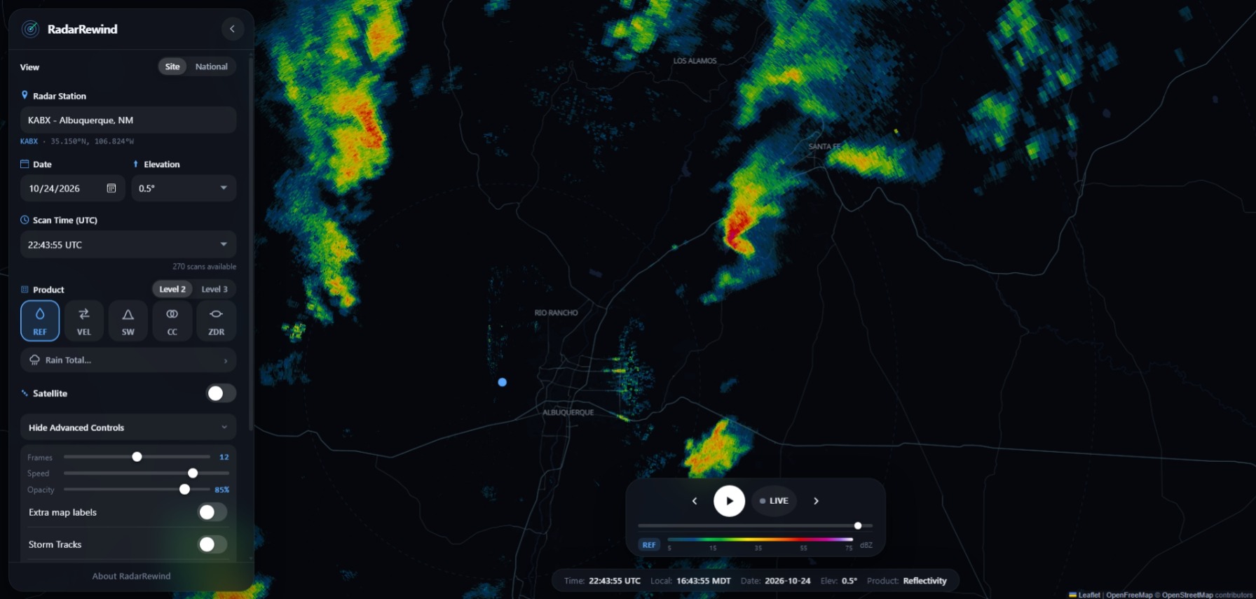
Radar velocity image at the same time:
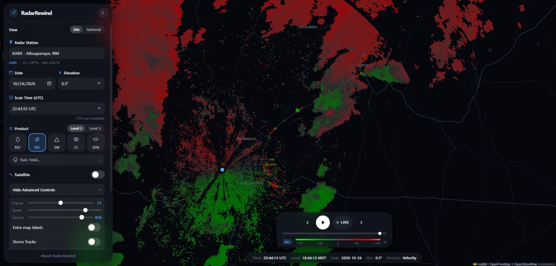
On this archived radar velocity image, the velocity couplet is not quite as obvious as it was on RadarScope, but you can clearly see it, in the same place as the hook. On the velocity image, look for the red and green together, in the same location relative to the interstate highways as the hook on the reflectivity image. This velocity signature indicates rotation within the storm.
However, I could not see much of this storm from where I was. It was the next storm to the south of the one in the pictures above, and my view of it at that location was blocked by terrain. So, I moved west on 599 just far enough to get a reasonably clear view of the storm, stopping near Unity Church. Stop Number 2 on the map. The storm was far away, but with a large wall cloud decently backlit, and periodic appendages under the wall cloud extending closer to the ground. Not sure of time, but likely a little before 5 p.m., maybe 4:50.
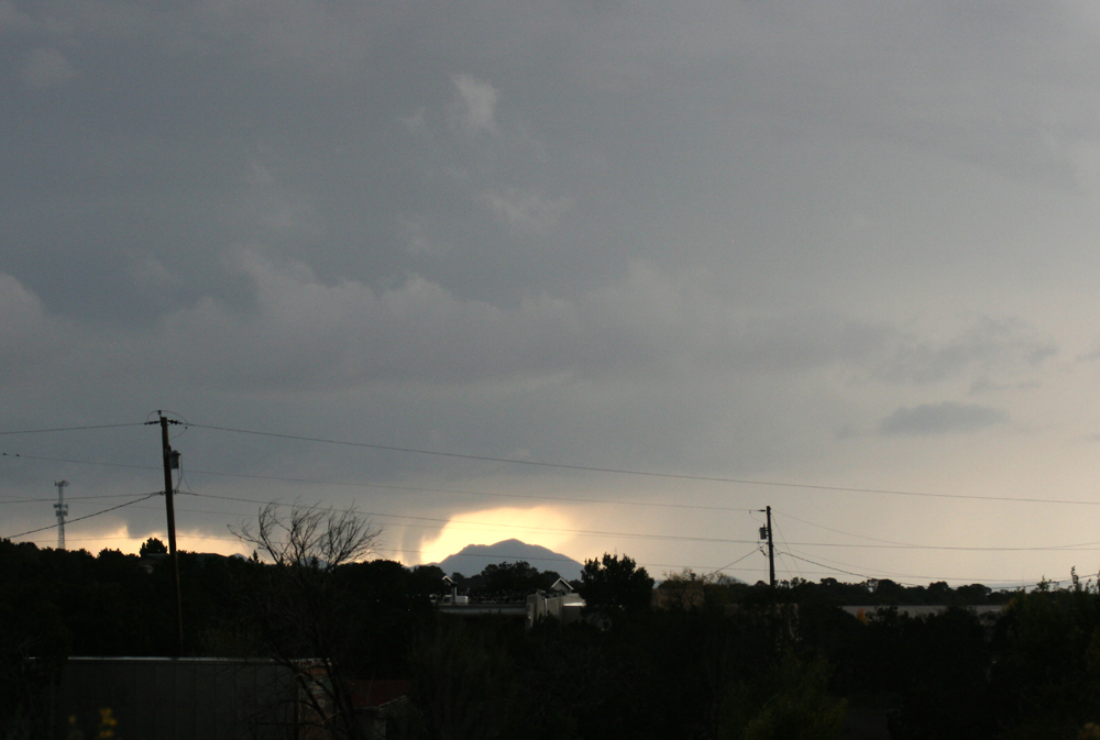
I then moved well west on the frontage road to near the S. Meadows Road exit, maybe a mile at most east of there. This stop was at the intersection of Vereda de Cochiti and the 599 frontage road, Stop 3 on the map. Now maybe 5:05 p.m.
These two pictures show how the atorm looked when I first arrived at this location. Still a big wall cloud:
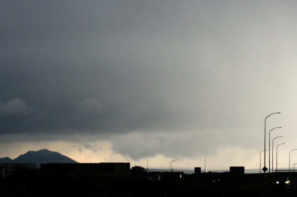
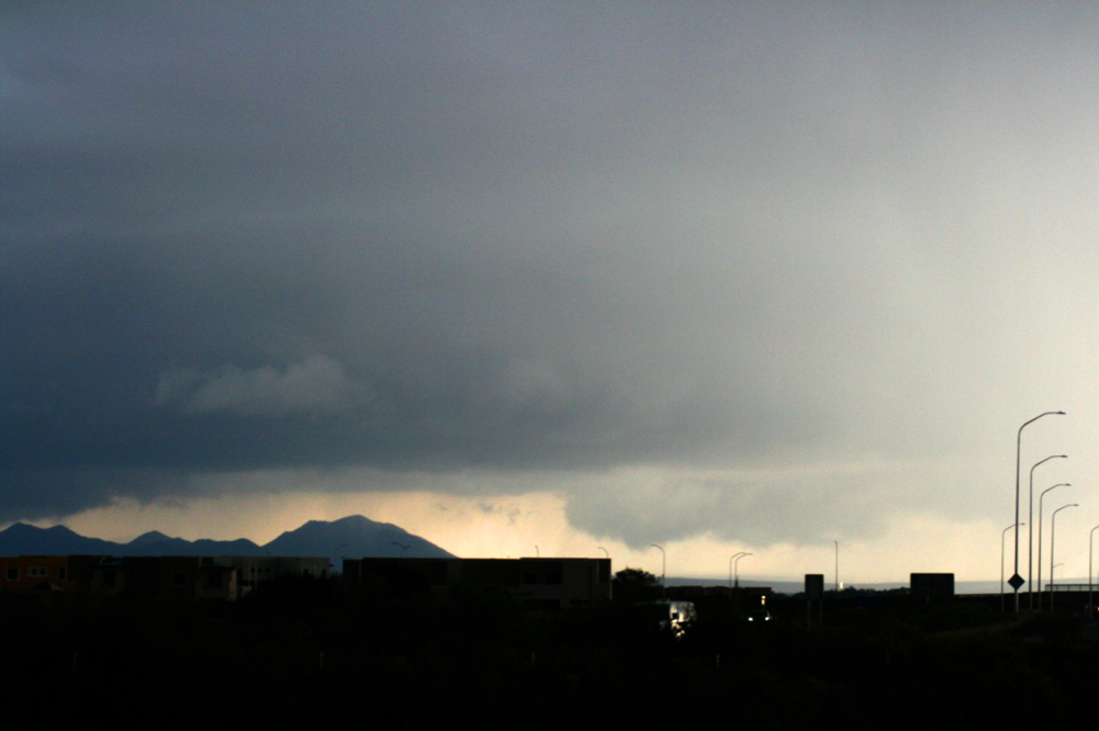
The storm cycled a few times. There may have been a brief funnel, and an intense, narrow precipitation shaft formed, kind of a look-alike, but intense localized precipitation, not a funnel. The original wall cloud had become rain-wrapped and was north of these new features, a sign the storm was cycling. Here are a couple pictures showing that phase of the storm:
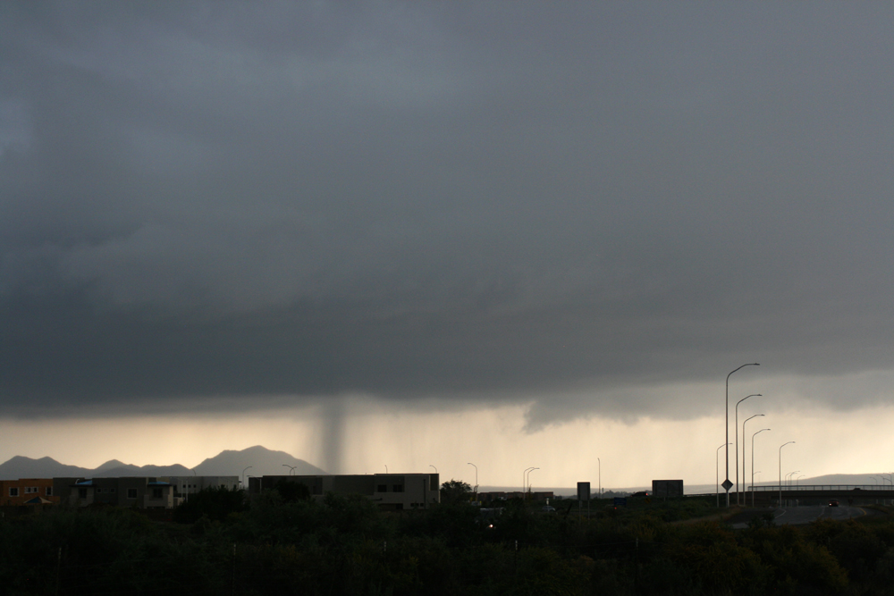
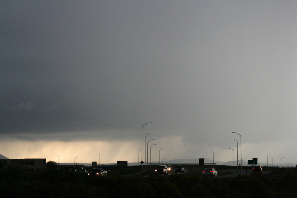
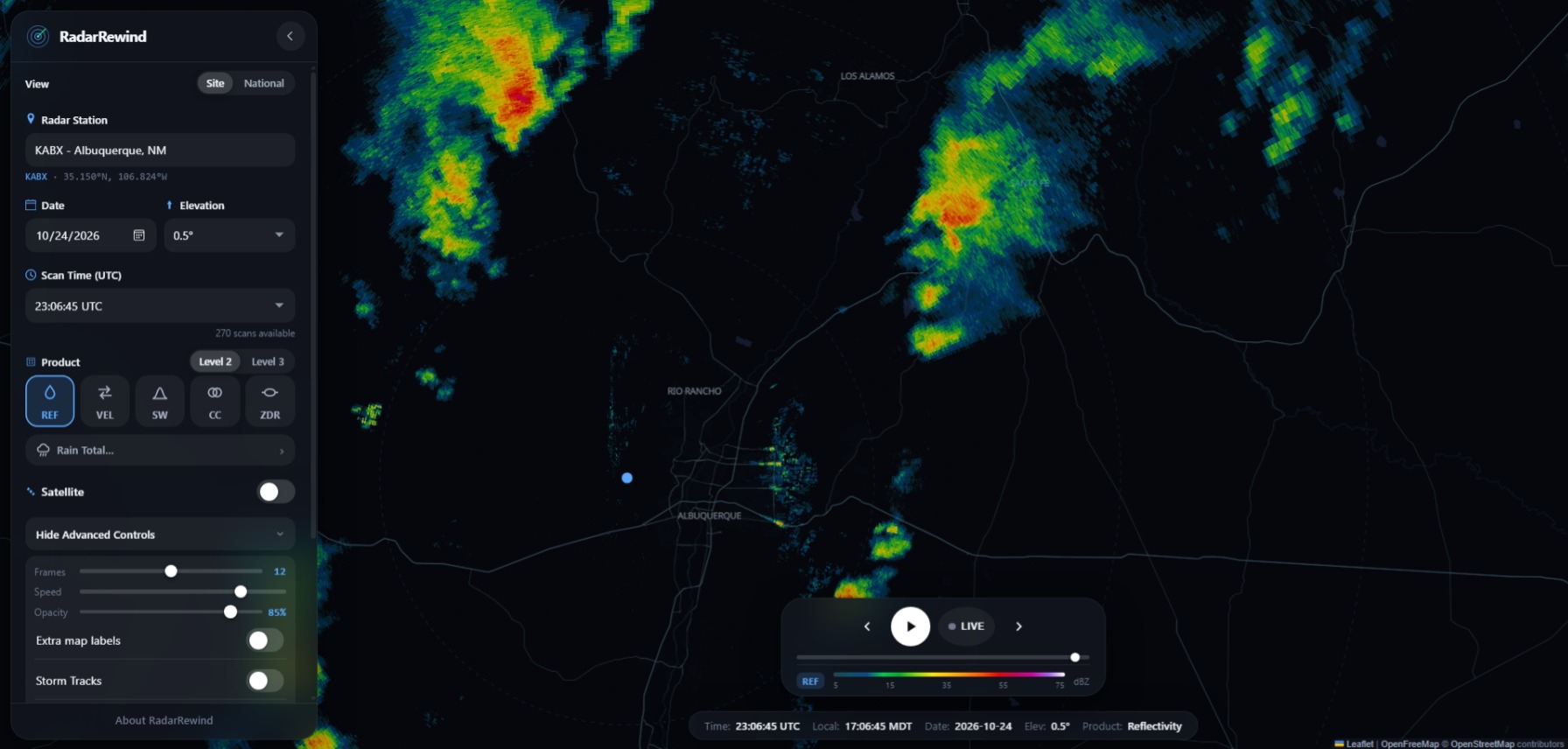
Here is a radar reflectivity image from 5:07 p.m., while the storm was cycling. Notice it looks more disorganized than in the earlier radar image, as an old meso occluded and a new one was about to form. Now a weaker and less organized storm:
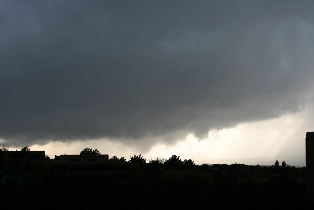
After maybe 5 or 10 minutes at this location, the storm seemed to be weakening and I was thinking about the need to get back for our dinner plans. So I started back toward Santa Fe on the frontage road. But after a few minues I noticed in the rear-view mirror that a new, large wall cloud had formed, so I stopped again to find a viewing spot before I even got to a place to get back on 599. I found a couple good viewing spots in what I think was the Aldea de Santa Fe subdivision. This location is stop 4 on the map. This was the best structure I saw with this storm, at least from anywhere close. Some of the best all season, although it had been a pretty limited chase season until fall. Soon what appeared to be a funnel cloud formed and persisted for ten minutes or so. There was cloud-scale rotation, but I could not tell for sure if the lowering was rotating, but it sure had the look of a funnel. At times, I was viewing it through a little rain, but it was nicely backlit the whole time. I took most of the pictures with a DSLR after my first stop on this chase, and the time stamp on that camera is incorrect, but I did take one final picture on my phone when it was time to head home for our dinner plans, and the time stamp on that is 5:23 p.m. Here are 5 pictures of this likely funnel, from various places in the subdivision that had clear views:
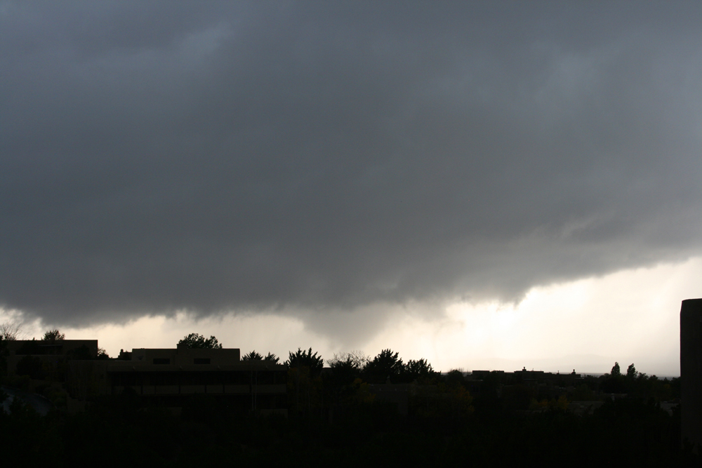
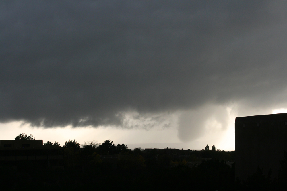
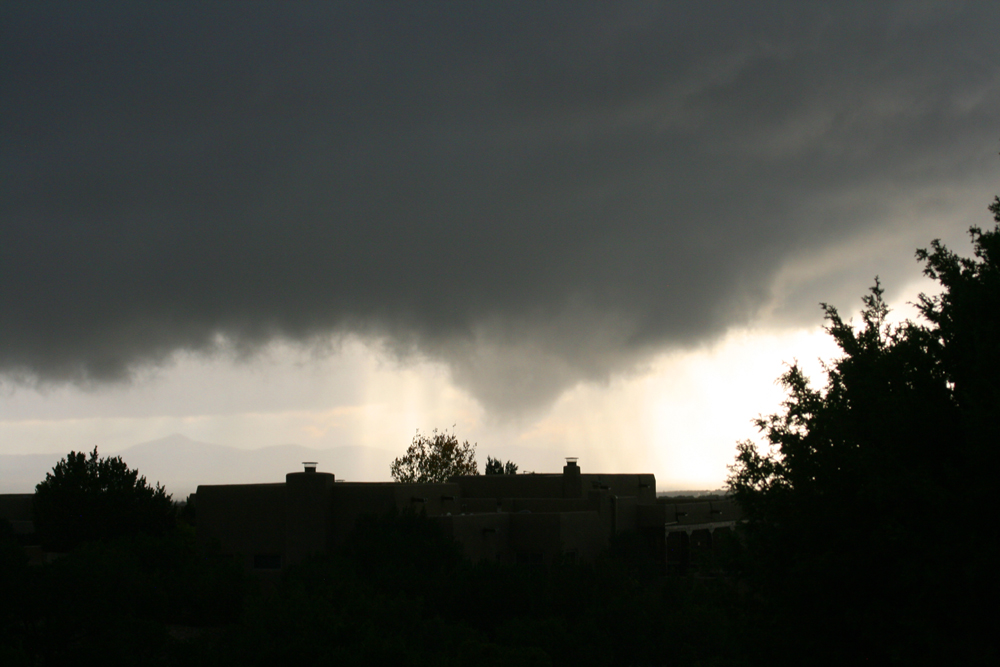
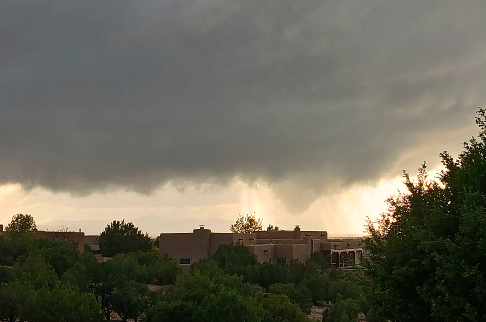
I mention the time of my last picture because on FB and in the Albuquerque Journal there is a picture taken at 5:29 from the same subdivision where I was of a lowering condensed all the way to the visible ground in the picture. Here isa link to a picture of this feature on Facebook. This picture was taken by Michelle Vialpando. You can click on the linked photo and see a few other of her pictures too. In the comments on this picture, there were questions raised by a commenter about the authenticity of these pictures, but I think they are indeed authentic. Right place and right time. I wish I had been able to stay for a few more minutes to see for myself, but time did not allow.
So is this a tornado? Can't say for sure, because there is some high ground between, and you can't tell whether it was all the way down. Also, despite some social media chatter, I have seen no reliable reports of damage in the area where the lowering was, likely by then near the Las Companas subdivision. So I don't know if there was a brief tornado or not, but I have no compelling evidence that there was. Can't say for sure it wasn't, though, either. With my last picture about 6 minutes before Michelle's, I will say that I MAY have gotten a developing stages of a weak tornado, or possibly the beginning of it, but probably not. so this will go in my chase spreadsheet as "possible tornado." I would put the chance that I got a tornado or even the beginning stages of one at no more than 20 percent, though. In any case, the NWS allowed the SVR warning to expire at 5:30 and the storm weakened rapidly after that as it continued to move north, away from Santa Fe.
Here are radar reflectivity images from from 5:12 and 5:18 p.m. They do show that the storm became better organized in that time frame, even forming a bit of a hook echo signature:
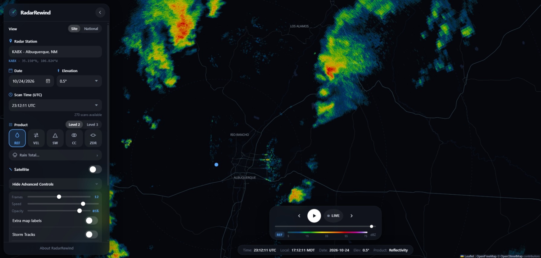
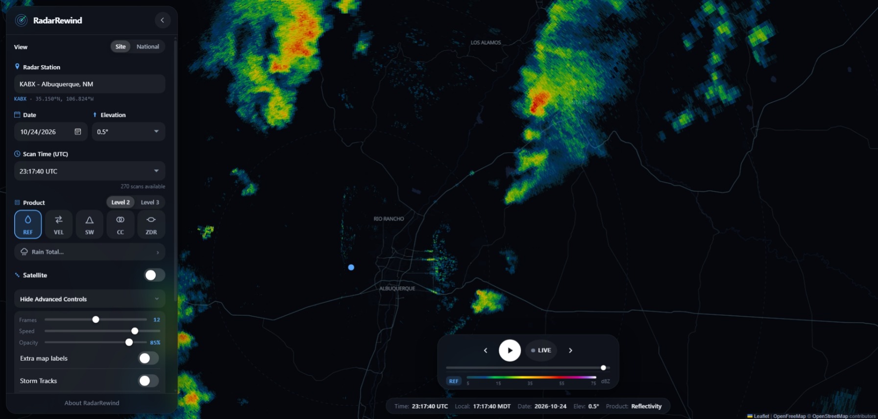
Here is a reflectivity image from 5:29, the time of Michelle's picture. Strong echo and hook, for sure:
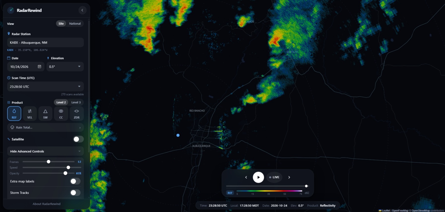
After this, the storm weakened, both visually and on radar, and did not look particularly impressive by the time I was getting back into Santa Fe.
Attention then turned to the planned dinner at The Pantry, where we were meeting our friends around 6:15. We left for there a bit earlier than planned, because another storm had developed to the south down the line and this one was heading for Santa Fe. As we were going to the restaurant, it looked pretty strong, although the updraft area was hidden by precipitation and/or cityscape. Not long after we got to the restaurant, thankfully in only light rain, SVR warnings began to be issued on the new storm. But we were mostly concentrated on having an enjoyable dinner with out friends, so I did not pay much attention when my weather app occasionally beeped. That is, until . . .
Right around 7, my phone alarmed for a WEA emergency alert. As did lots of other phones in the restaurant - quite dramatic! There was a tornado warning, with radar-indicated rotation right over Santa Fe. A minute or two after the phones alarmed, a loud steady noise ensued, I think from hail hitting the roof of the restaurant. It was interspersed with louder bangs as a few larger hailstones mixed in. After a minute or so of this, curiosity overcame caution and I went to the window of the restaurant along with quite a few others. This window faces Cerrillos Road, facing away from the southerly wind. There was a lot of fairly small hail falling, but by the time I could get the video going on the phone, it mostly stopped. This hail was in the range of .5 to .75" in diameter. But then I noticed one much larger stone, likely in the 1.5"-2" range washing down the street in the water running down the street. Turns out I got this when I landed. In the video below, watch the far right side of the video - you will see it land and then immediately start washing down the street. Clearly bigger than almost all the stones on the ground, though I am sure there were at least a few others in that size range in the area. Here is the video:
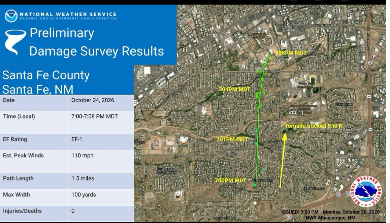
Shortly after I got this video, the hail ended and other than some rain and thunder, no moe significant weather at the restaurant. But the tornado warning was not issued in vain. An EF-1 tornado made a track a mile and a half long through pretty near the geographic center of the city, moving just east of due north. Turns out the worst damage was only a mile or so southwest of the restaurant where we were, and about at the time I was filming the hail. Four minutes later, it ended only a half mile southwest of our location! Had it stayed on the ground longer, it would have crossed Cerrillos Road only two tenths of a mile southwest of where we were, or slightly closer. So I am glad it lifted when it did.
Here is an image from the National Weather Service (NWS) in Albuquerque showing the track of the tornado and a summary of the damage survey:
Here is a series of radar reflectivity images from around 6:46 to 7:17, before, during, and after the tornado, which was on the ground from 7:00 to 7:08 p.m.:
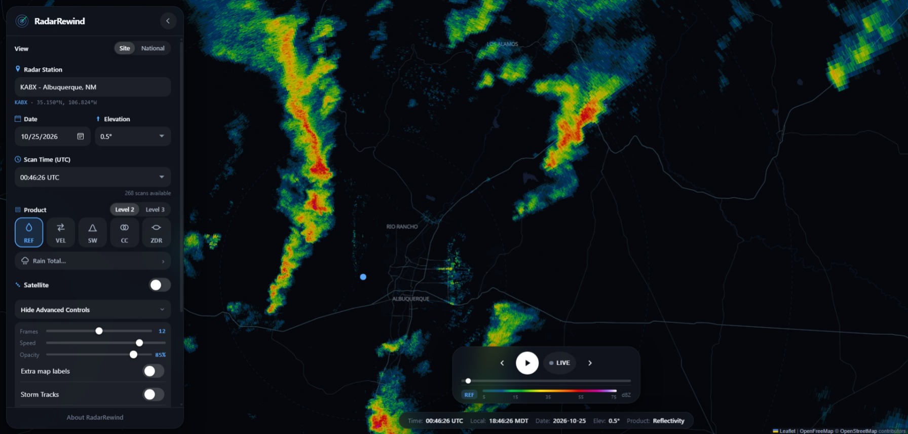
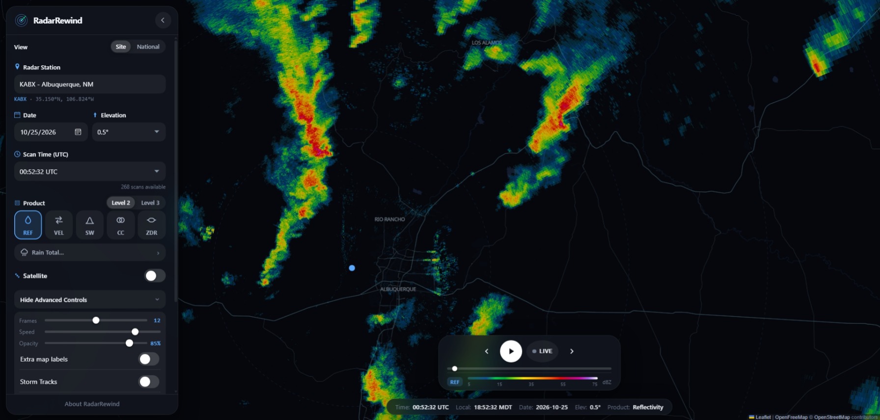
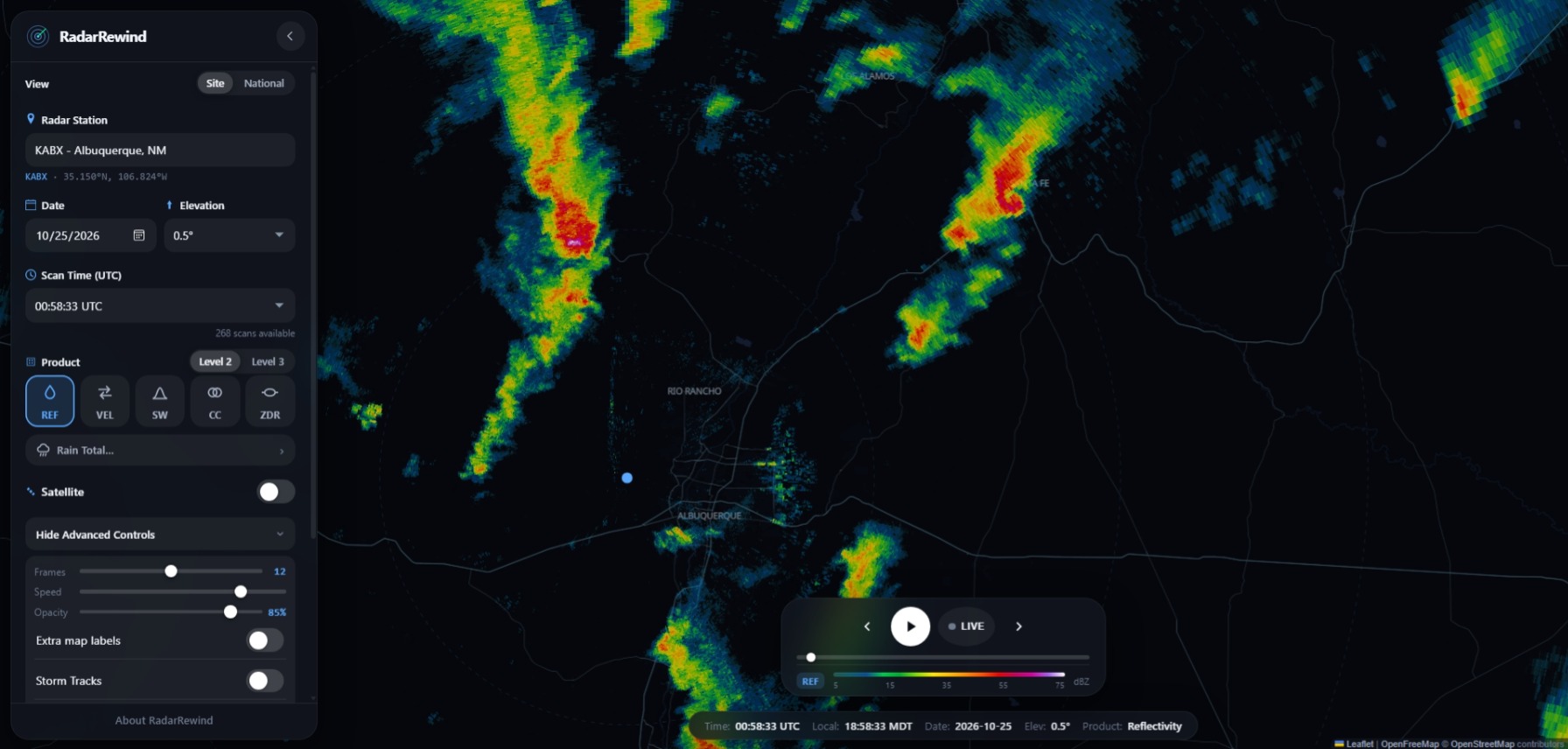
The image above is from around a minute and a half before the tornado began. Definite hook echo!
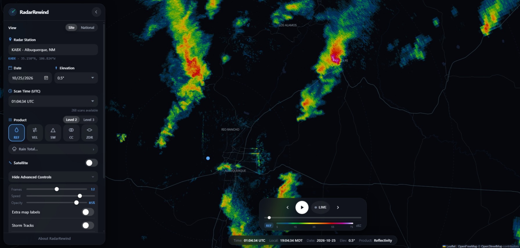
The image above is from about the mid-point of the tornado. Less of a hook echo, but evidence of hail and/or debris in the air.
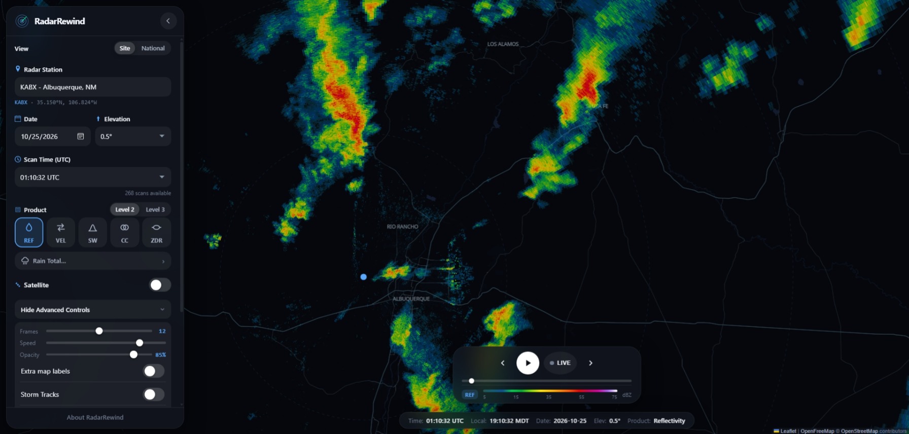
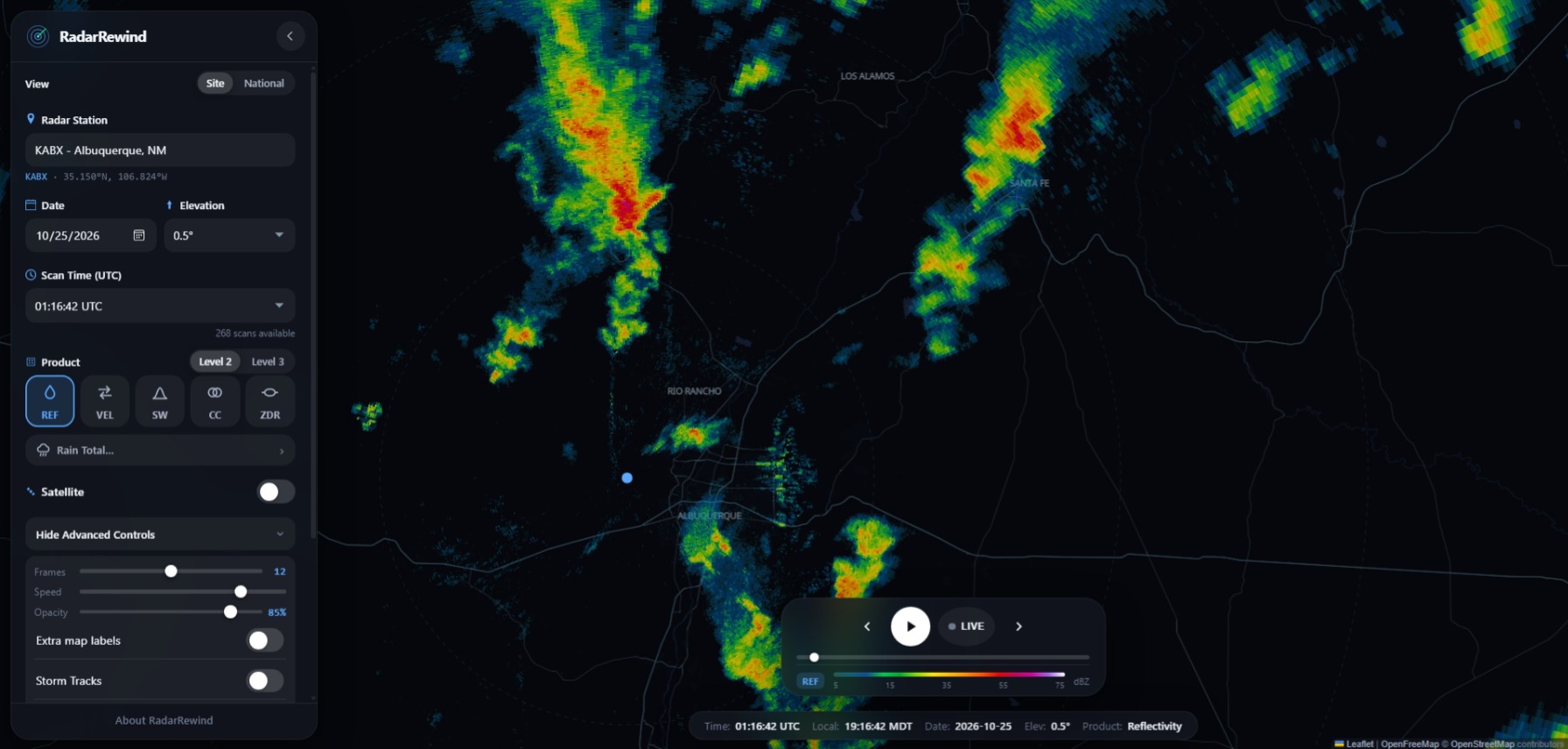
By the time of the image above, the storm was north of Santa Fe and weakening.
And here are a couple of radar velocity images, both showing evidence of rotation:
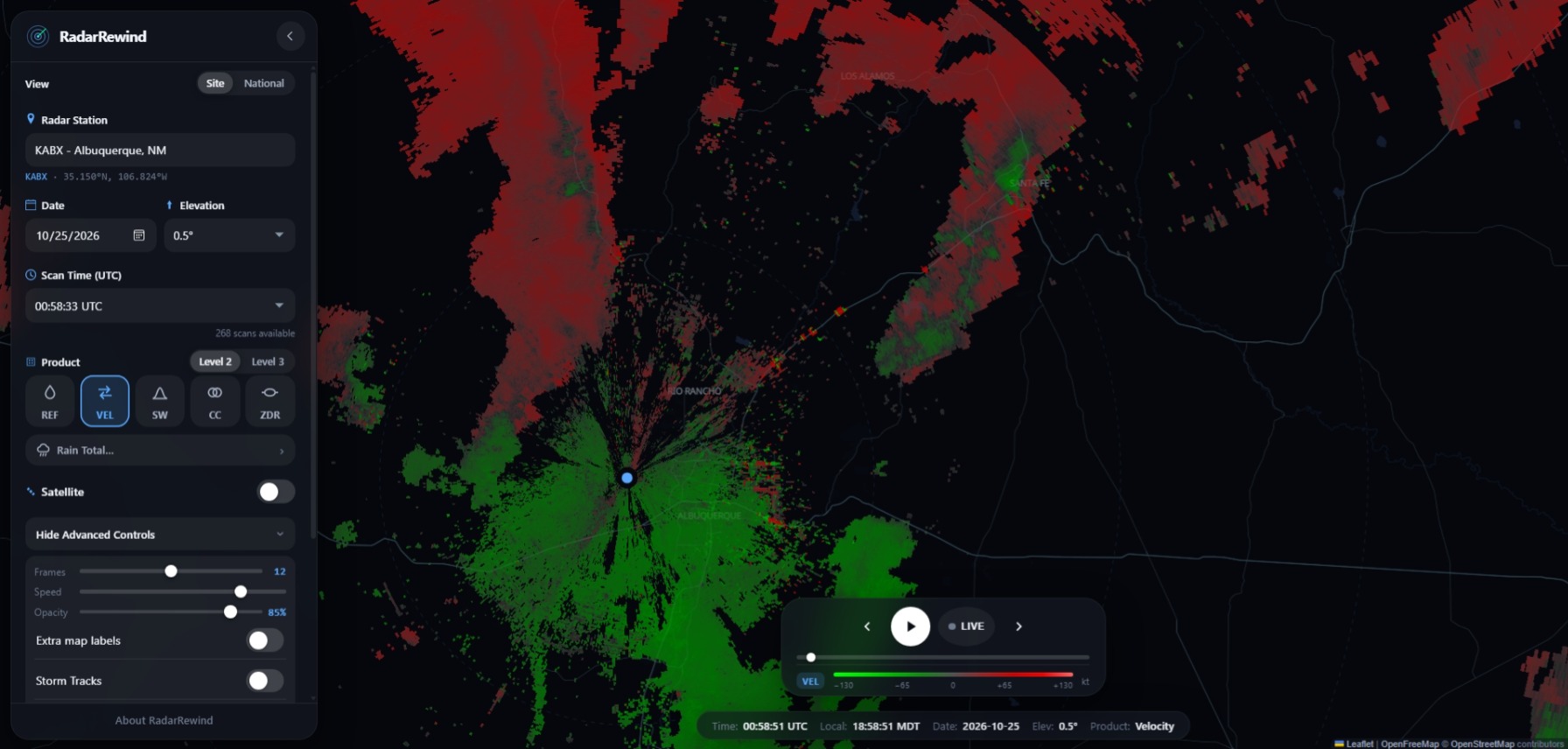
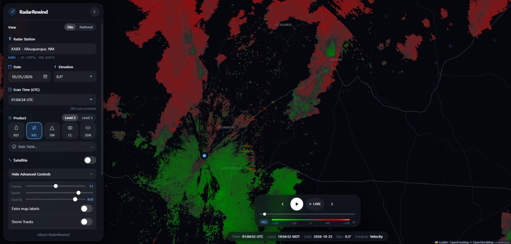
The first of these miages is from around a minute and a half before the tornado began, the second from about the mid-point of the time it was on the ground.
Fortunately there were no injuries in this tornado, despite considerable damage. A couple roofs were removed, with lots of damage to fences, cars, trees, and power infrastructure. Trees came down on cars and at least one house. And sadly, while nobody was injured in the tornado, there was a woman who was killed when the car she was riding in was swept away trying to cross a flooded arroyo. This happened only a mile or so north of where I photographed the earlier storm, although I do not know the exact time when it happened. Please, people, DON'T DO THAT! Farther north, in northwest NM and around Pagosa Springs, CO numerous people had to be rescued, in a number of cases by helicopter, after doing the same thing. And elsewhere in New Mexico, two other people drowned, one near Dulce, NM and another near Soccorro, NM, both after attempting to drive through flood water. That is three totally preventable deaths with this storm sysstem, just in New Mexico. Nothing is worth putting your life and the lives of others, or even your vehicle for that matter, in that kind of danger. If the flooded road is your only way out, WAIT. With time, either the water will go down, or somebody will be able to rescue you. Better than you or your passenger drowning, or you watching your vehicle wash down the flooded river, creek, or arroyo.
A broader report and analysis on the Four Corners Storm of October 21-25, 2026 can be found here.