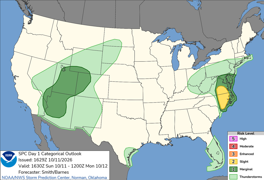
Here is the thunderstorm outlook for the day from the Storm Prediction Center (SPC):
As you can see, SPC had a marginal risk closer to the track of the remnants of the hurricane, mostly along and to the right of the track, but not as far east as New Mexico or even Durango, CO, which is about 50 miles west of Pagosa. So the Pagosa Springs area and all of New Mexico were well to the east of where SPC expected severe weather, but I still thought there might be an outside chance of seeing something, particularly once I got closer to Pagosa Springs. And see something I did!
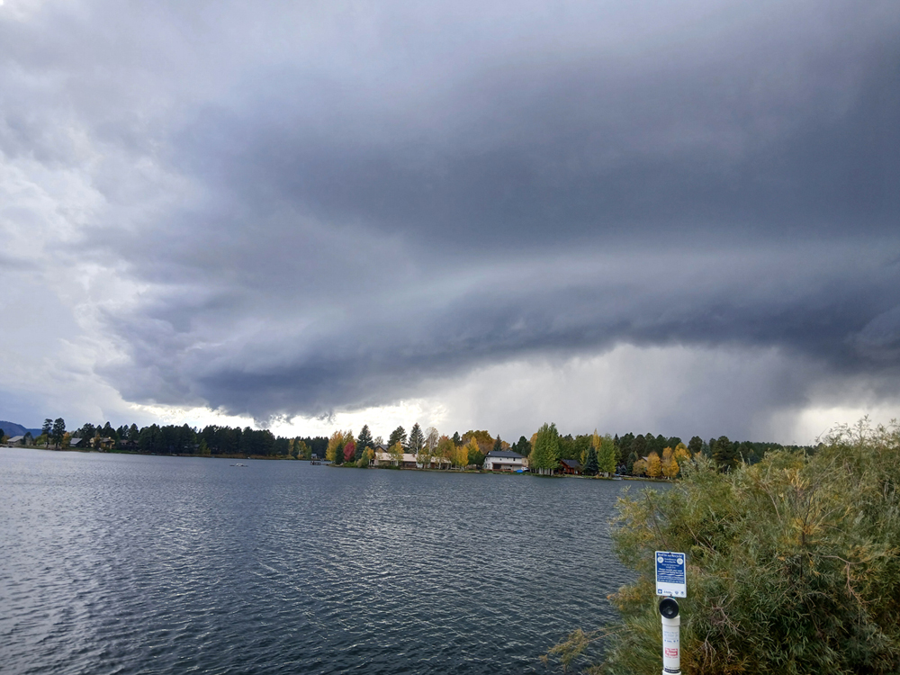
A little after 4 p.m., as I was approaching Pagosa Springs, I could see that there were strong storms to the west and northwest of Pagosa Springs. The closer I got, the more interesting they looked, so I decided to go a bit north on Piedra Road to a favorite fishing spot on Lake Pagosa which I knew would have a good view of the storms. As soon as I turned onto Piedra, heading northwest toward the lake, there was a bright flash of lightning - the first I had seen all day but far from the last. Turns out these storms were very electrified. I also noticed that as I was heading northwest, a brisk wind was largely at my back but from a bit more easterly direction than I was headed, making it a southeast to east-southeast wind. This meant that, at least in the immediate storm environment, the inflow to the storm was at a sharp angle, 90-degrees or less, relative to the storm's northeastward motion. This would mean that the storm would encounter good directional wind shear, not just speed shear, increasing the chances of storm rotation. When I got to the lake, there was a good view of the storms, which were in a broken line. The second-nearest storm to the tail end of the line was very strong, with heavy precipitation and lots of lightning. Just to its southwest, under a stout updraft, the tail-end storm was rapidly taking on the appearance of a supercell. In fact, it quickly formed the best supercell storm structure I have seen anywhere in 2026:
The lowered area under the cloud base was directly below the updraft tower, as can be seen in this picture:
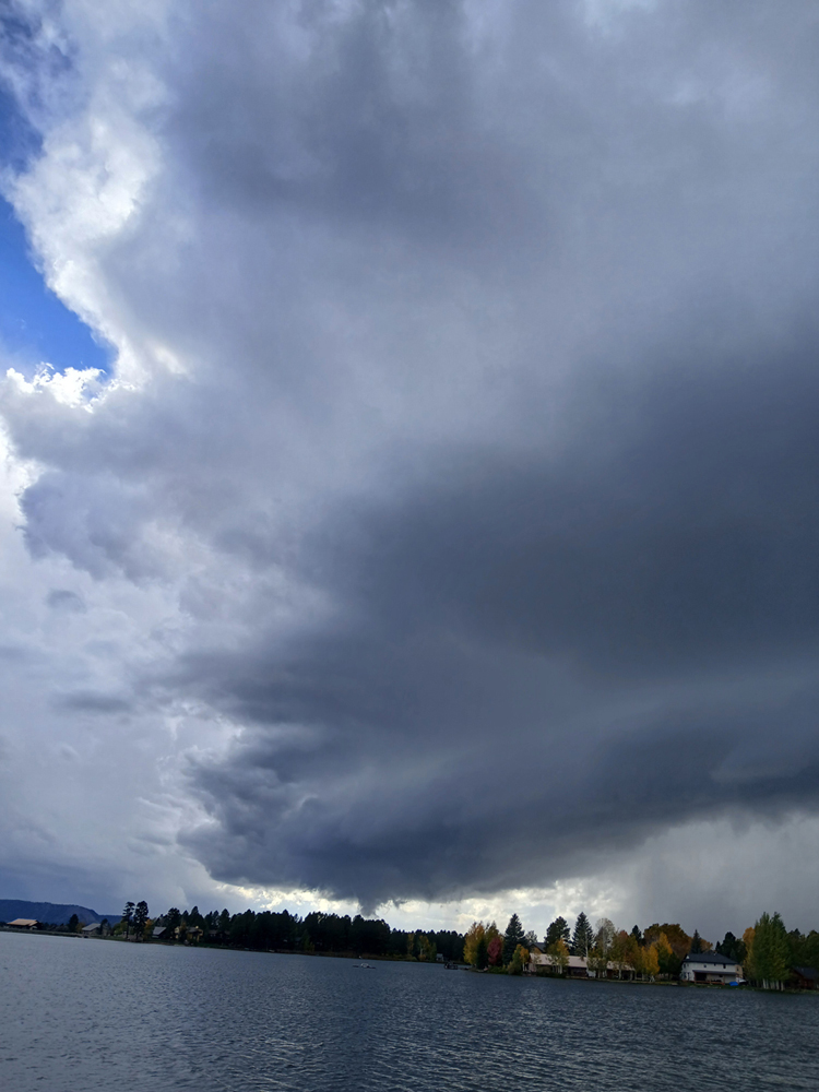
The lowered area and the cloud tags near it appeared to have a slight bit of rotation, but nothing strong enough to maike me think there was any immediate risk of a tornado. After 2 or 3 minutes, the lowered area disappeared, but soon another one formed on the opposite side of the tail-end cell, between it and the next storm up the line:
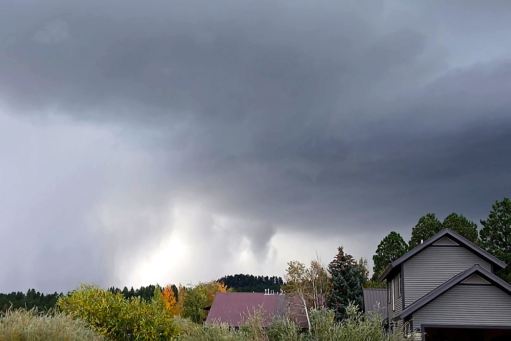
Although this has the look of a funnel cloud, I do not think it was, because there was no visible rotation and, tellingly, the cloud tag just to the right of the main lowering stayed in that position, rather than moving to the left behind the main lowering.
I was curious about possible hail from these storms, even though their tropical origins made that somewhat less likely. As the storms continued to the northeast (and seemed to start weakening as they did), I first tried driving up farther on Pedra Road, but could not go far without driving into the core, which I did not want to do just in case of hail or wind that might bring down a tree onto the road. So I circled around on the winding roads to eventually get to North Pagosa Blvd., which is farther west but also goes generally to the northwest. Got into an area where there had been lots of rain, but I did not see any evidence of hail there so I headed home.
There was hail, though. Pagosa Weather posted video of the storm on their Facebook page - they were pretty much right in the path. It showed blinding rain, strong wind, and small hail. Many pictures and videos were subsequently posted to that thread, including a report of a measuered gust around 40 mph. I have no doubt there were some stronger gusts in the area that were not measured. Many posts in the thread mentioned the intense wind, rain and small hail at their locations, and one also mentioned a very loud roar. At the start of the day, I knew that I might get a strong storm somewhere on the way between Santa Fe and Pagosa Springs, maybe even a supercell. But I did not have on my card that I would get the most photogenic supercell I have seen all year, viewing it from a location only a mile or so from home.
There were a fair number of severe wind reports, even one or two of hurricane force, with storms farther east in Colorado, many from around Alamosa and northeastward into the Pueblo area. I may have seen the first of several storms responsible for those reports when I was passing through the Chama, NM area around 3:15. The sky to the north and east of there, up and over Cumbres Pass, was very dark, and just west of Chama I passed through a swath several miles wide that had obviously gotten an intense burst of rain shortly earlier. Here is SPC's map showing the severe weather reports for the day:
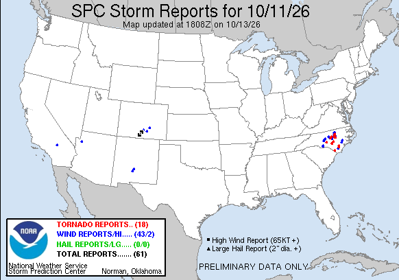
It is interesting that all of this weather occurred east of the area that was outlooked by SPC for a marginal risk. The northeasternmost report may have even been outside the general thunderstorm area in the outlook. Not much occurred at all in the outlooked area in terms of severe weather. I am thinking that the storminesss farther east than outlooked probably goes along with the idea that supercells and severe weather associated with tropical systems usually occur on the right side of the storm's track. That certainly was true with regards to the remnants of Hurricane Rachel in this case - all the weather occurred to the right of the storm center's path. (The center moved roughly over Las Vegas, NV and continued northeast, well west of where the most intense storms occurred.) Much the same was true of the tornado outbreak in North Carolina, well east of the path of the remnants of Hurricane Isias. It is also intersting that probably every severe report on the map was associated with remnants of either Pacific Hurricane Rachel or Gulf Hurricane Isias.
Return to 2026 Severe Weather Observation page
Return to main Severe Weather Observation page