I headed north from Edwardsville on I-55 around 5 p.m. or so expecting storms to fire on the front draped east-west across central IL, which had been stationary but was now showing signs of starting to move back north as a warm front. It seemed like the potential for severe storms and possibly supecells was good, as the warm sector was very unstable (CAPE 3000 or more), with some shear as the surface wind was nearly southerly and mid and upper winds much more westerly, and I thought that shear might be locally further enhanced right along the front.
Howerver, the initial storms fired to the east, around Decatur, and moved rather quickly to the northeast. I got suckered east by these storms to Decatur, but once there, I realized these were storms that I had no chance of catching. It seemed like the front was moving north faster than I had expected, and SPC issued a mesoscale discussion talking about the potential for severe weater mainly north of about Peoria. I was about ready to hang it up when I noticed decent looking storms to the NW, so I blasted north to Bloomington on U.S. 51. Soon after I did, a tornado watch was issued for Illinois from around Decatur to the north. So between that and the storms firing to the north and west, I started to feel better about my chances of seeing interesting storms.
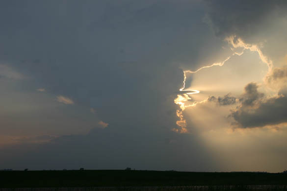
Along the way north on route 51, I saw a storm to my west very nicely lit by the sun. I stopped a couple times to take pictures, as this storm was very photogenic. I am not sure, but it is possible that this storm is the same one that later produced the tornado. If not, it was very near to the storm that did.
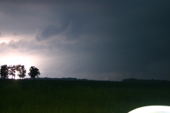
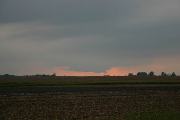
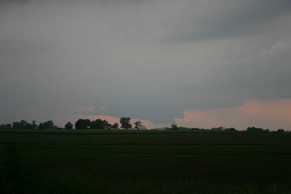
As I got close to Bloomington, I could see intensifying storms all over to the north and west of the city. Around that time I heard a SVR warning for a storm near Eureka, and decided to target that storm. I debated going north on U.S. 51/Interstate 39 to intercept the storm, but opted for a more direct route toward it on I-74. My only hesitancy about going this way was that it might take me right into a storm, either from the next one south of the one I was initially targeting (which turned out to be the storm that produced the tornado, not the one I first targeted) or from one developing from the updraft bases I could see just north and northwest of town. But I avoided any heavy precipitation and exited I-74 at U.S. 150, the first exit after 74 splits toward the NW from I-55 on the west side of Bloomington-Normal. I opted for 150 because it went in the general northwest direction toward the storm, and because it gave me far more escape options and places to stop than the interstate, which should usually be avoided during the active phase of a storm chase. I proceeded to just west of Congerville, then turned north and found a spot to view the storm. It was quite a distance away, near or north of Eureka, but it had a nice backlit wall cloud that I could see well from this location. The wall cloud continued to look good for a while, but gradually began to be obscured by rain from the storm to the south. I knew I had to either move north or give up. Moving north turned out not to be an option, as the road turned to mud a mile or two north of Congerville. So, when I lost the wall cloud in the rain I worked my way east and south, and I figured out that once I got a ways south, I could double back west to the next storm, which was also SVR warned.
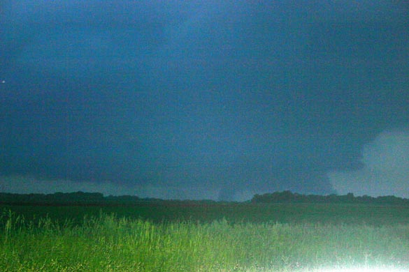
As I got around, I could see that this storm, which was the southernmost in the cluster, had a really hard updraft and backsheared, knuckled anvil - and as I got close, I heard the initial TOR warning which was based on a spotter report.
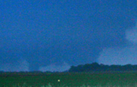
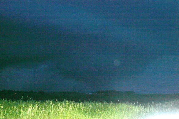
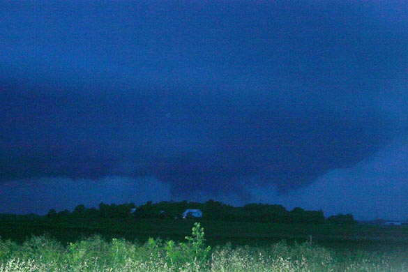
At that time, I was just approaching Danvers from the east. I went through town and, after a brief bit of road confusion, I turned north and found my viewing spot a mile or two northwest of town; by then it was maybe 5 minutes or so after the initial report and warning. I got to a good spot to view the storm, and there the tornado was! When I first got in position to view it, about 5 minutes after its initial formation, it was a stout stovepipe, to my west-northwest, under a large, low wall cloud:
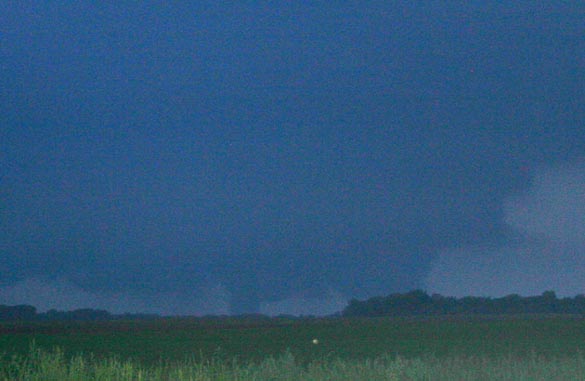
Similar image, more cropped/zoomed:
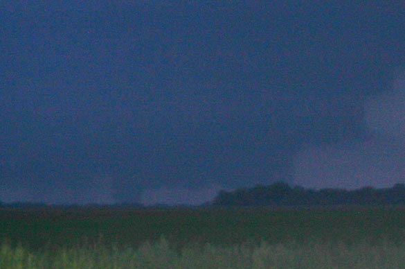
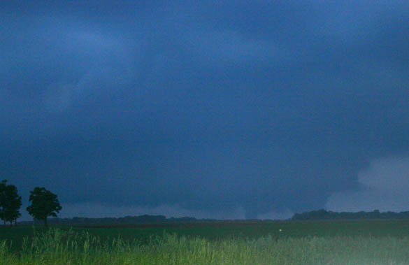
It evolved into a multiple-vortex structure:
It was fascinating to watch during this phase, as new condensation fingers would form, rotate around the wall cloud, and dissipate, only to be replaced by another new one. Occasionally there were 2 or 3 visible at the same time.
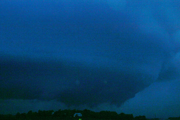
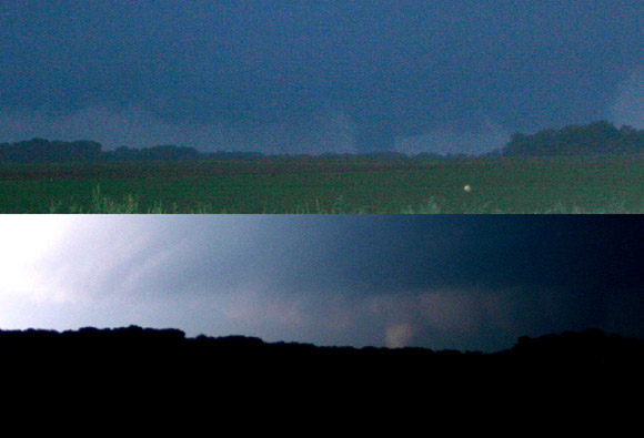
Toward the end, it became larger, and began to wrap in rain:
It was on the ground, at least intermittently, for a good 20 minutes. I watched it for about 15 minutes, though I cannot say for certain that it was down continuously for that entire time - but it was, at least intermittently, down for about that amount of time. What I saw was pretty consistent with the spotter reports listed in on the LSRs. The last I can say pretty confidently that it was a tornado was when it was to my NNW - after that it was too wrapped up in rain to be sure. I was probably 6 or 7 miles from the tornado for most of its path, so I was a little too far away to tell if it was down continously or intermittently - but there were certainly times, as shown in the first couple photos above, where the condensation was solid to the ground and others when condensation fingers seemed to come up from the ground.
Near the beginning of when I was watching and photographing the tornado, I accidentally got a photo just as lightning flashed to the south of the tornado. It illuminated the tornado, as can be seen in the first picture below. Another picture with the same degree of zoom is immediately below for comparison - you can see the tornado in exactly the same place in both photos, just to the left of the cluster of trees on the right - front-lit by the lightning in the first photo and slightly backlit in the second one.
Below is a picture combining slightly more zoomed versions of the pictures above, contrasting the tornado with and without the lightning:
After getting on tornadic supercells but missing the tornadoes the last 2 chases, this was a very pleasant change. My best chase of the year, and one of my best ever!
I got a little video of the tornado, though not as much as I wanted because the camera battery was low, and unfortunately slightly out of focus. But it does clearly show the tornado. Here is the video:
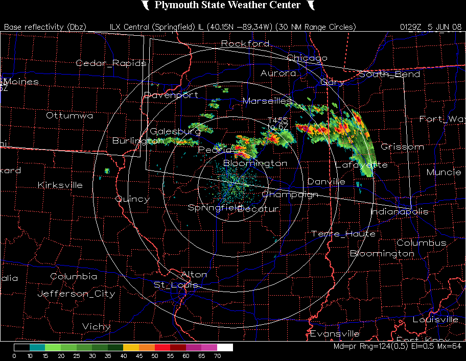
A radar image from about 8:30, while the tornado was occurring, can be seen here. Note the hook echo northwest of Bloomington. Although this tornado was on the ground at least intermittently for about 20 minutes, it fortunately stayed over open country and did not hit any structures. From what I have heard, about the only damage it caused was some uprooted trees.
-------
UPDATE: The following appeared in an online articple posted by the Bloomington Normal Pentagraph on June 6:
Matt Barnes, meteorologist for the National Weather Service in Lincoln, said a tornado touched down briefly about 2˝ miles northeast of Mackinaw about 7:20 p.m. It lifted and touched down again about 7:25 p.m. four miles northeast of the town, he said.
During the second touchdown, the tornado stayed on the ground about 18 minutes, crossing just into McLean County and then into Woodford County, Barnes said. It lifted about 1˝ miles south-southeast of Congerville, he said.
The tornado moved mostly through fields and uprooted trees, and there were no reports of structural damage.
“It was out in some fields,” said Bill Nowlin, coordinator for Tazewell County Emergency Services and Disaster Agency. “It came down and went back up several times.”
NOTE: The times listed above are an hour too early. The correct starting times for the tornadoes were around 8:20 and 8:25. The path and times of the tornadoes are also described on the 2006 tornado list from the Lincoln NWS. The path of the second, longer tornado is very consistent with what I observed. From this, it would seem that I was able to see the second tornado for most of its duration. Mapping out this path, I would have been about 7 or 8 miles from the tornado when I first saw it, and about 3 miles from it when it ended. The path length of the tornado was 6 miles.
ADDITIONAL Update: I have added links to a number of media, video, and chaser reports on the tornado. A couple of these indicate that there in fact were a couple buildings damaged - a house that a tree fell on, and a barn or shed that lost its roof. For the most part, though, the tornado stayed in fields and woods, downing lots of trees but causing only these two relatively minor instances of damage to buildings. Here are the links to the reports:
Younews Video looking east on Dee-Mac Road from Mackinaw area
Younews Video of tornado in Deer Creek-Mackinaw area from about 1.5 miles away
PJstar online newspaper article
News 25 story on damage. Links to many photos and videos of tornado
Youtube video of the storm from a distance; shows storm structure and in-cloud lightning.
I don't know how long any of these reports will stay on the Internet, but they all work as of 8/15/08.
-------