I decided to head out for the severe weather setup in southeast Colorado for Thursday, May 21. In a year when storm chasing opportunities have been limited in the southern plains, I decided to give it a try, even though I could only chase the one day and it was far enough away to require overnight travel. A backdoor cold front had stalled against the mountains a few days earlier. By this day it would be somewhat washed out, but moist upslope flow on the cool side of the dissipating front would provide some instability. The upslope components combined with what was left of the front and the orographic effect of the mountains would result in sufficient lift for storms, and an incoming shortwave would provide additional forcing along with good deep layer shear, with westerly upper winds over the surface southerly winds. Dewpoints and instability would not be great, but certainly adequate for storms at the elevation of the high plains. CAPE, a measure of instability, would be at least in the 1000-1500 range, maybe even 2000 j/kg or better in localized areas. Dewpoints would be in the 50s, and all models showed storms breaking out in east-central or southeast CO and moving east or ESE, although the area did shift somewhat southward over successive runs, perhaps getting northeast NM, the western OK Panhandle, and the northwest TX Panhandle into the act. Most models showed storms initiating around 2 or 3 p.m., around 50-100 miles east of the mountains. And with the directional shear, there was a good chance that some of them could be supercells, though some models did show the storms growing upscale into a complex of storms known as an MCS (meso-convective system) toward evening, perhaps a linear storm system by then. The day before, the Storm Prediction Center (SPC) upgraded parts of eastern CO from marginal risk (level 1 of 5) to slight risk (level 2 of 5). By Thursday morning, this area had been expanded to include more of eastern CO and nearby parts of KS, NM, and the OK and TX Panhandles.
The Chase:
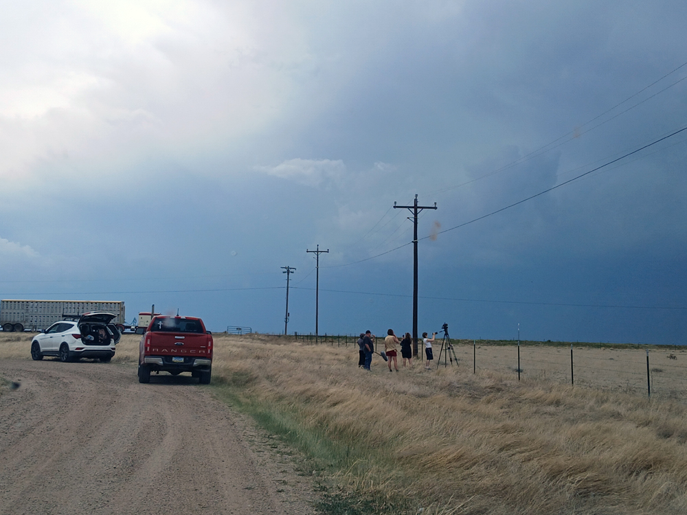
I started from an overnight stay in La Junta, working east to Lamar then south toward Springfield. Things did not go particularly as planned, because storms initiated earlier and farther west than models indicated, near the mountains and before noon. One near Trinidad, and another between Raton and Springer, NM. Thus, I ended up blasting back west on 160 from Springfield to intercept the storms, once I realized that these were the main storms for the day and nothing was going to initiate farther east as the models had indicated. As a result of that early and more westerly initiation of the storms, and likely also of a lack of low-level shear despite considerable deep-layer shear, they grew upscale into an MCS rather quickly, and did not form sustained supercells. Although there were supercells early on, they rather quickly morphed into a more or less linear storm complex, though still with some supercell structures embedded. Despite the storms' rapid growth into a linear structure, they were quite photogenic at times. I had been concerned that there might be big chaser traffic jams, since it was late May, a lot of people were on chase vacations, and there had been massive jams a week or so earlier in Kansas. And as I know from experience, big chaser jams do occasionally happen in Colorado. But not on this day. There were quite a few chasers out, like the ones in the picture below taken near Kim, CO a little after 2:00 p.m., but nothing unmanageable:
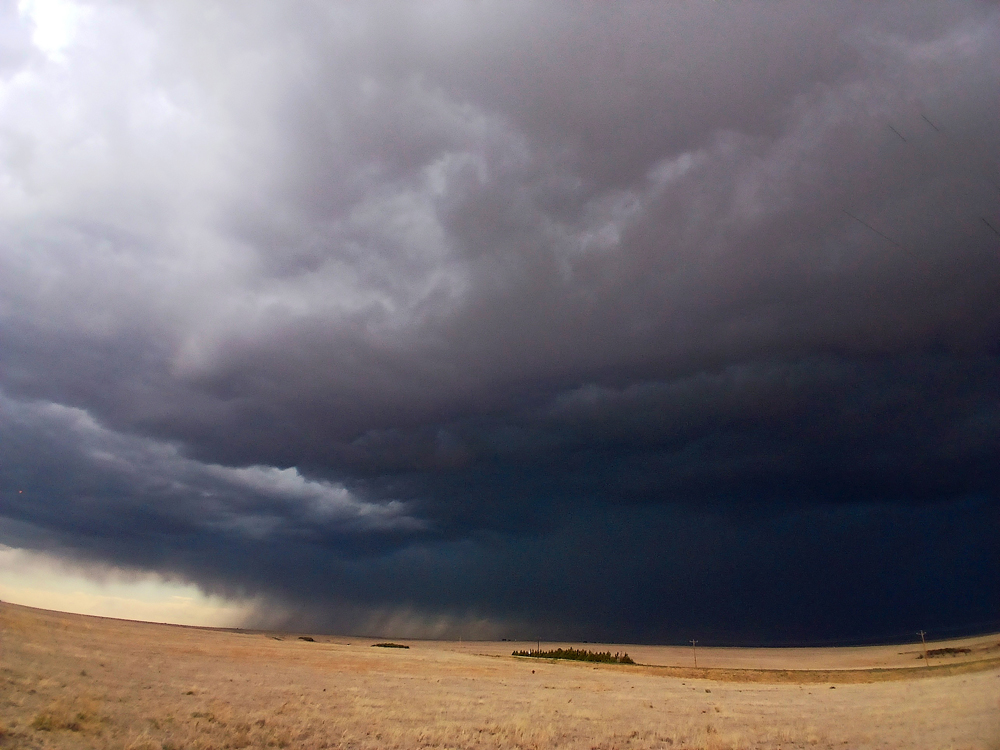
As you can see in the picture, the storms were still a fair distance to my west, in a broken line with some embedded supercells, alligned WSW to ENE and moving generally east. So I continued on past Kim for maybe 10 miles or so until I was closer to the storms, then worked back east on 160 staying just ahead of the storms. This took me through Kim and back to the spot where the chasers were hanging out, where I watched the storm for a few minutes, but then left and continued east as the first outflow wind arrived. The outflow was surging a few miles ahead of the precipitation at this point, but the storms were not moving terribly fast so I was able to get back ahead of the outflow and into the warm, juicy southerly surface flow again. As the storms moved into this, they intensified and becamme a bit less moisture starved and less high-based, and thus by 3:30 began to look more impressive:
As I again moved east toward Pritchett, CO after taking this picture, I saw what I am pretty sure was the feature reported as a landspout by an NWS employee. To me at the time, it looked more like a gustnado, but now looking at my only picture of it (I was driving on 160 with no good place to stop, so taken through the window), I can see the argument for it being a landspout. There is a feature above it in the right place in this picture, taken near the end of its short lifecycle:
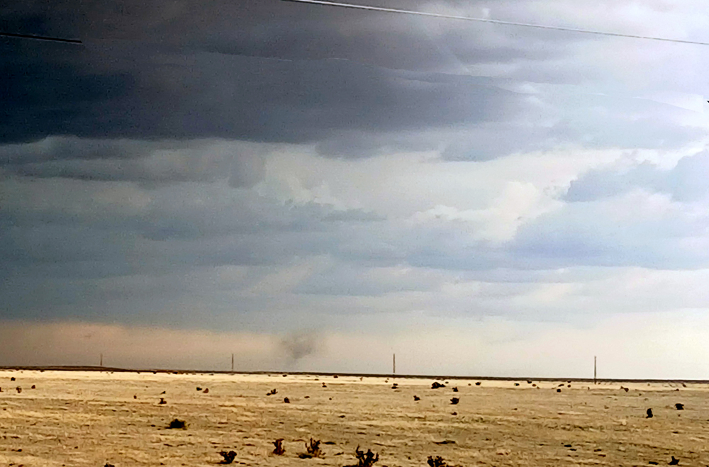
Although this certainly may have been a landspout - in addition to what I mention above, it was big, intense, and went pretty high - there also reasons to believe that instead of that it was a gustnado. It was along the leading edge of the outflow, where gustnadoes form when the outflow interacts with the inflow, and both of those were strong with this storm. Also, it only lasted about one or two minutes, at least from when I first saw it. Both of those things are typical of gustnadoes. So bottom line, it could have been a landspout, but it could also have been a gustnado. It did show up in SPC's storm reports as a landspout tornado, likely because it was reported as such by an NWS employee. But either way, landspout or gustnado, I am glad I got a picture of it.
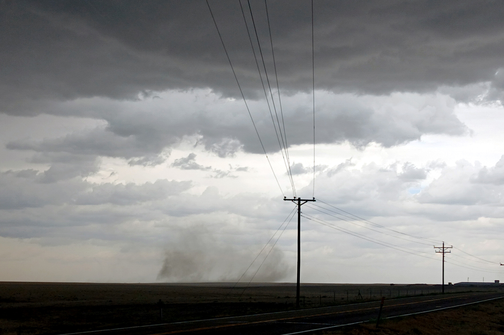
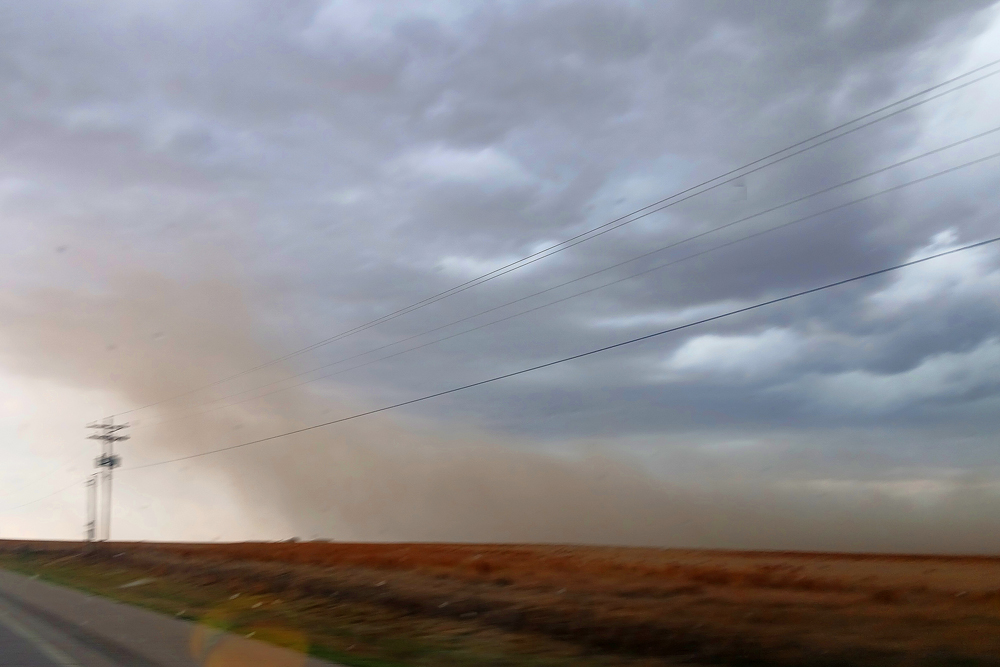
After the first picture, all the dusty thingies were outflow-related, but some were pretty impressive as the storm produced several microbursts along the leading edge west of Springfield. The first ones after the feature pictured above also had some embedded areas of rotation (gustnadoes), as in the photo and video below:
Hee is video of this feature, or possibly another that followed in the same general area:
At the time, I was not entirely sure if there was rotation going on in this area of blowing dust, but after reviewing the video it was evident to me that there was - gustnadoes. As I got closer to Springfield, I also was closer to the area of strongest wind, having been behind it earlier. By this time, it was all straight-line wind, as can be seen in this video:
As I got to the intersection of US 160 and US 287 just south of Springfield, I could see the town getting enshrouded in dust, but the intensity of the wind seemed somewhat less by then. The peak gust at the Springfield airport was 49 mph, but it was likely stronger in the microbursts earler west of there and, later, south of there.
At this point, I could have either continued east on 160 to stay ahead of the storms, or drop south on 87 to intercept storms down the line. I opted for the latter, because I had to drive back to Pagosa Springs the next day and continuing east would have taken me well into Kansas, making the drive longer. And I was hopeful that some supercellular structures might form in storms down the line to the southwest, maybe even catching a tail-end storm.
As I drove south from Springfield, there were more microbursts west of US 287 that I observed while driving from Springfield toward Campo, mostly in the first 10 or so miles going south on 287. The first of these microbursts produced a big cloud of dust south of Springfield, blowing toward the highway:
After passing through some blowing dust from that, there was a rather intense dust plume from another area of outflow a bit farther south of Springfield, looking southwest:
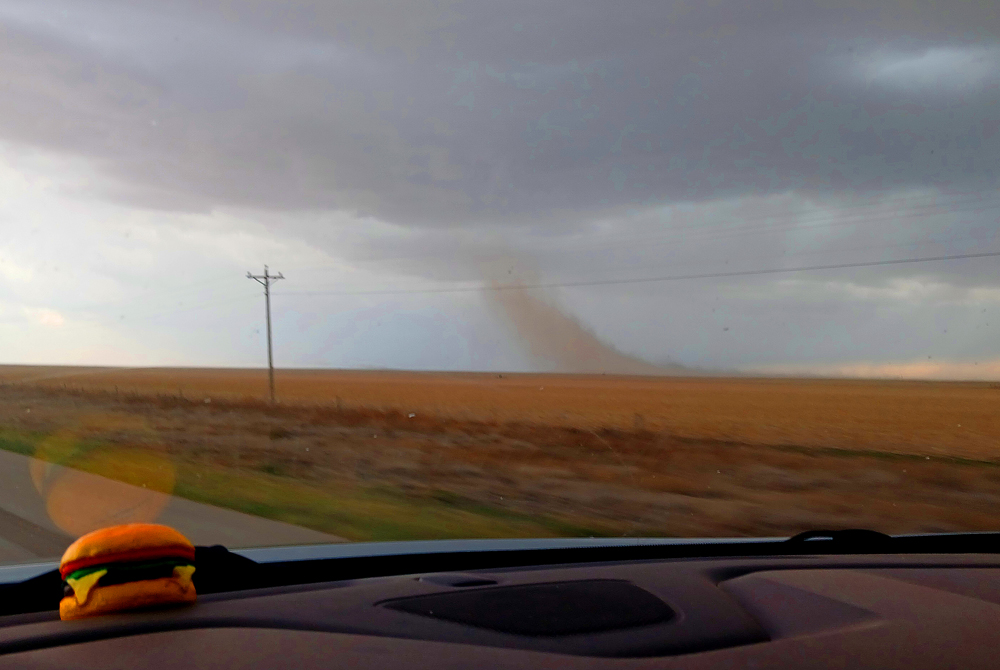
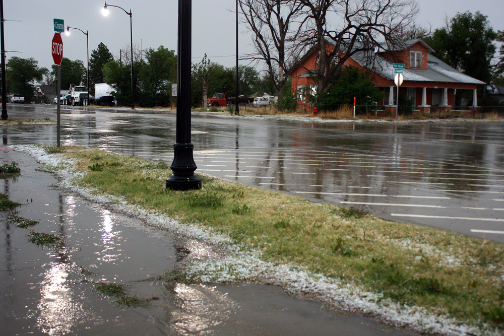
This picture was taken through the windshield. (Yes, I still have the cheeseburger given out at the 2014 Chasercon in memory of Tim, Paul, and Carl, and often put it on my dashboard when chasing.) The storms backbuilt faster than I could blast south, so there was going to be no catching the tail-end storm. By somewhere near the CO/OK state line, I could see there was going to be no chance to avoid getting overrun by the storm, and I already had encountered a couple bursts of hail between Campo and Boise City, OK. So I found a canopy to get under in Boise City, and got video of the barrage of hail, heavier and longer-lasting than either I had encountered on the highway. It was all small, 1/2 inch at the largest, but there was quite a bit of it. There was also torrential rain and a lot of CG lightning.
As you can see in this picture and in the video below, there was enough hail to accumulate on roofs and on the ground:
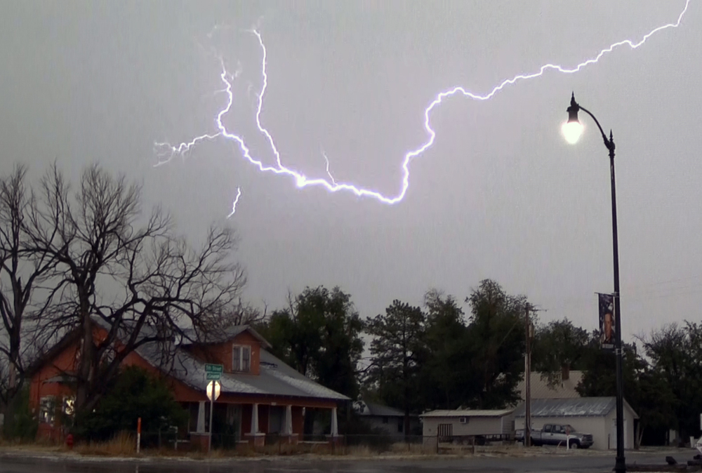
Some of the most intense lightning came in a burst just after the main hail core had passed over:
I was able to pull a number of video frame captures of lightning from the intense barrage that occurred just after the hail. This one is my favorite:
You can see more here.
After that, I headed west to Clayton, NM for the night, but did stop to get some mammatus pics:
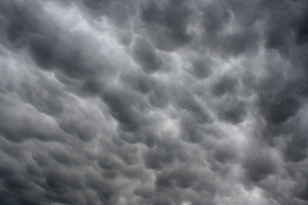
This was taken west of Boise City, looking southeast.
Chase distance:
240 miles home to La Junta, where I stayed the night before the chase day.
333 chase day miles.
310 miles returning from Clayton to home.
883 miles total chase trip distance