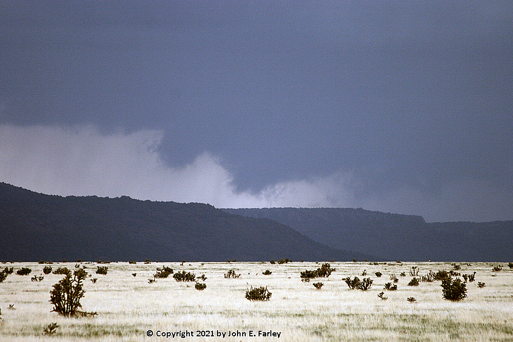
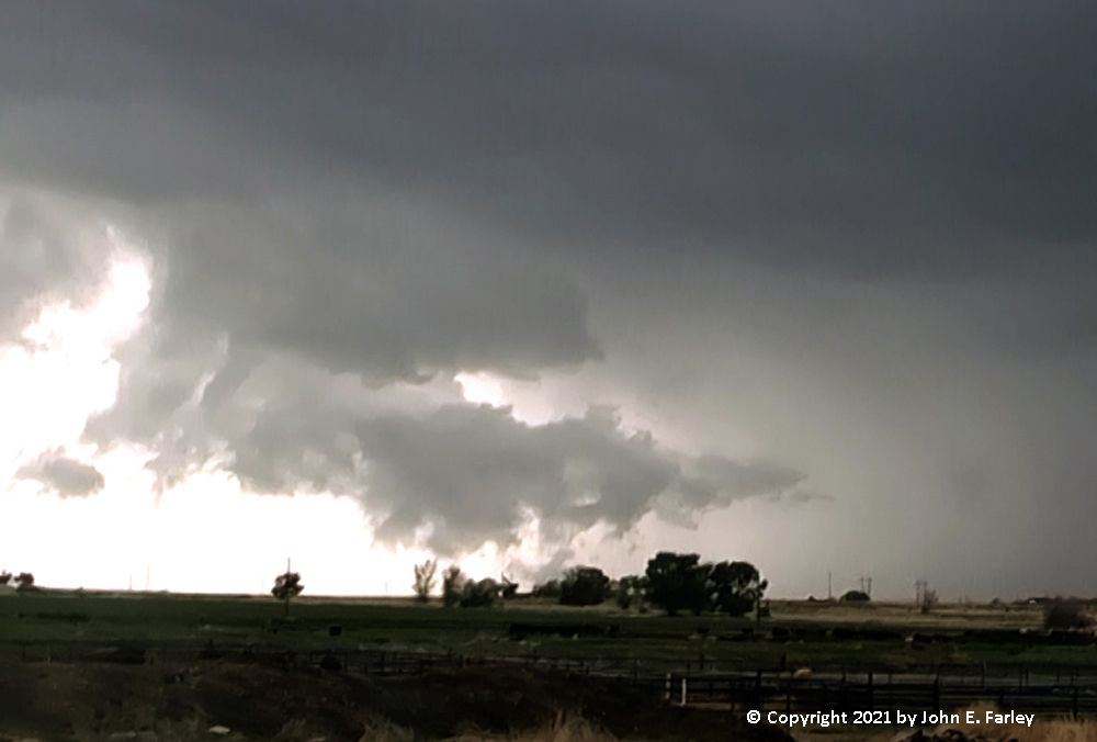
When I looked at the models and forecast discussions the morning of the chase, the target was less clear. CAMS were now showing at least as much activity around and south/southeast of the Palmer Divide as they were near the Raton Mesa, with connsistent signals among several of them for an intense storm somewhere near or a little north/northwest of La Junta. When I headed out around 10:30, I decided to make La Junta my target. I did notice convective clouds building up west of Trinidad and thought about waiting a while to see what they would do, but I decided to stick with my forecast and move to La Junta. As morning turned to afternoon, the convection near Trinidad shifted southeast to the west end of the Raton Mesa just southeast of Trinidad, and intensified. By around 2:00 p.m., with no sign of any storms even trying to develop near La Junta and the Raton Mesa storm continuing to intensify, I decided to head back to the Raton Mesa, via Kim and Branson, CO. I figured it was early enough that if the storms did eventually form near La Junta, I could go back, but now I had an intense storm near the Raton Mesa, vs. a chance of one near La Junta. Just before 3 p.m., the Raton Mesa storm got its first SVR warning, until 3:45. That would be renewed, until 4:45. The storm was reported as moving slowly, only around 10 mph. I could see, visually and on radar, that storms were developing down the line from this storm to the east and then eventually to the south. RadarScope on my phone indicated an intense precipitation core and strong rotation with this storm, over or just south of the Raton Mesa in NM, ESE of Raton. It gradually became clear that the mesocyclone was located in the comma head of a developing bow echo. By the time I could get some distant pictures through the rain from near the turnoff from 160 to go south to Branson, CO, I knew I was looking at a bow-head mesocyclone, or at least something that was rapidly becoming one. At this time, around 3:50, there was a large lowering/wall cloud, which I could see through the rain between me and the meso. At this point, around the time the second SVR warning was issued, I was probably still somewhere around 30 miles away. Here are a couple pictures from there:
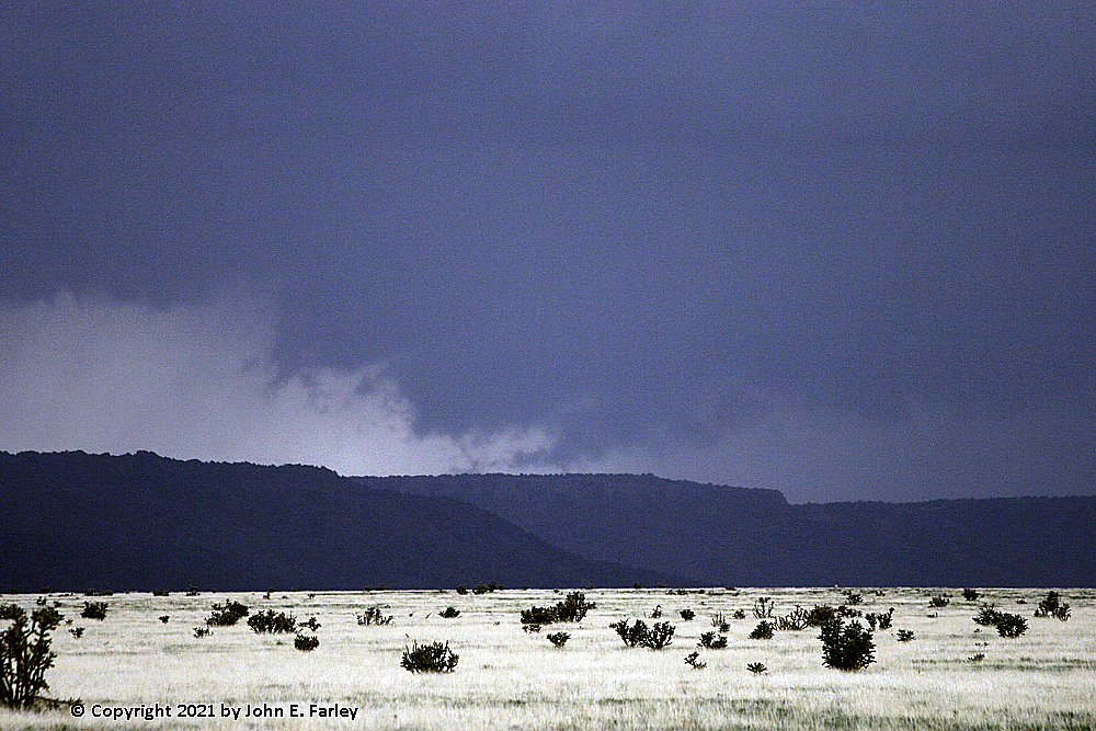
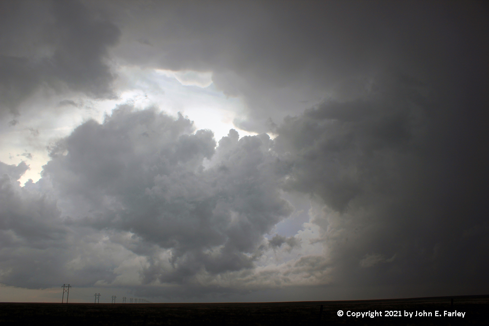
I continued through Branson and up the mesa into NM. About 3 miles in, I came to a place with open fields and a fairly clear view of the now very-impressive meso. The bottom was blocked by the highest part of the mesa, but considering that I was in wooded, mountainous terrain, this spot had an amazingly good view, and still an internet connection, too. The meso tightened up and extended to somewhere lower than I could see over the mesa - for a short time I thought it had something of the look of a tornado, but that did not last long, and in any case I could not see the lowest part of it due to the mesa - but what I could see looked impressive:
This was around 5 or 10 minutes after 4 p.m. There is no doubt that this was now a bow-head circulation, as indicated by both reflectivity and velocity radar images, and also by the fact that I was still looking through some rain at the meso. Also, the storm was quite electrically active at this time, both near the meso and down the line to the east of the meso. There was a persistent lowered area for at least 15 minutes, with some broad-scale rotation visible and, for a time, a pretty strong rotation signature on radar. But never anything that made me think it was a tornado, even though it briefly had the look.
After the picture above, however, the lowering slowly weakened and broke apart as it continued to drift slowly north. Also, the radar presentation of the storm became less impressive. I decided to head back down onto the plains, possibly to head west toward Trinchera, CO to try to get a better view. But by the time I got back down to Branson, it seemed clear that this storm was weakening, and other storms were starting to go up on the outflow from the bow echo, to the north, northeast, and east. A post-chase analysis of radar showed that some of the storms to the east were also going up along a ENE-WSW boundary, likely a weak warm or stationary front, that extended across Kansas into far SE Colorado. I thought the storms to the north or NE might become the new show, so before long I was heading back up to La Junta. Gradually, a couple storms southwest of there and northwest of Kim began to take on a supercell look on radar, though at this point they were not all that impressive visually.
Meanwhile, SPC upgraded the severe thunderstorm watch that was in effect to a tornado watch for parts of southeast CO and southwest KS, based in part on the aforementioned boundary. The storms going up to my north, southwest of La Junta, were in the tornado watch, or would likely move into it. As I got closer to these storms, more storms developed and it appeared that a line extending from the WNW to the ESE was developing, with what was for a time the southeast end of the line just to my east. It looked like a place where something might develop, but it was moving away from me into a roadless area and would likely be hidden by rain before long, so I kept going. All across the sky in front of me, I could see a line of updraft base, with some precipitation cores in places underneath, extending all the way from the farthest of the original storms to my northwest around to the storm at the end of the line to my ESE. At 5:46, a SVR warning was issued for this entire line, even though some parts of it were not yet fully developed, and the warning included a "tornado possible" tag.
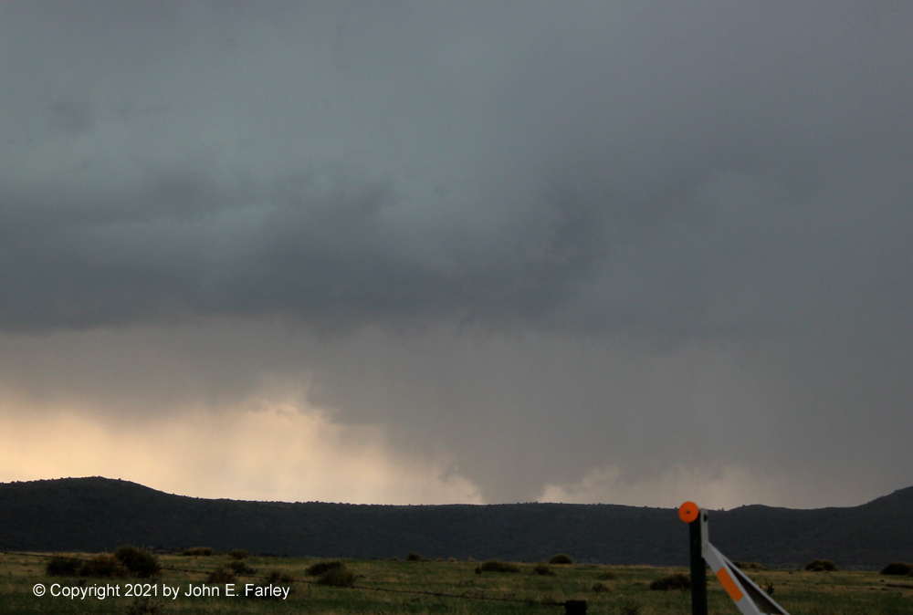
By the time I was a little south of La Junta, around 6:20, the storm that appeared to be at the western end of the line, looking to my WNW, appeared to take on a clear-cut supercell look, with a wall cloud and a tight, intense area of precipitation just to its north. A narrow lowering extended out of the wall cloud a minute or so later. At the time I was unsure whether or not it was a funnel, but given what happened shortly later, it likely was. Here is a picture:
What I could tell for sure was that there was indeed some rotation in the wall cloud. The narrow lowering drew back up part of the way to the cloud base, and then rather suddenly scud formed between me and the wall cloud and moved right to left, i.e. to the south or SW, in front of the wall cloud, partially blocking my view. I saw a couple narrow lowerings near the left edge of the wall cloud, one of which came close to the ground, but the scud was largely blocking my view and it was impossible to tell for sure what was attached to the wall cloud and what was part of the scud closer to me. Long story short, a tornado occurred under the wall cloud, 2 miles south of Rocky Ford, which put it about 10 miles to my WSW. I did not think it was a tornado at the time, but it was - the NWS confirmed it as a tornado after seeing video of surface rotation. (I later found a video by Tim Slane showing a dust swirl moving across a field at that location. Not a huge dust swirl, but given how wet it had been recently in that area, it would have taken a pretty strong wind to get any dust swirl). The tornado occurred at 6:24 and was reported to have lasted for five minutes, though the dust swirl video is much shorter than that. I am pretty sure the tornado is visible in this capture from my video:
I think the darker, narrow lowering, second one from the left below the wall cloud, is the tornado. I say that because there is a short piece of my video in which it appears between pieces of scud moving across in front of it, with subtle but noticable difference in movement from the closer scud - and it appears to be attached to the base of the wall cloud. It is hard to see because except for this short time in the video, it is largely hidden by the closer scud. And unfortunately, most of the motion that can be seen on my video is associated with the movement of the scud across in front of the wall cloud, but there was definitely rotation in the wall cloud, both before the reported time of the tornado and in the brief video clip. In the video, above the scud, you can see the base of the wall cloud rotating around the funnel, with movement from left to right, opposite that of the scud. Also the lowering noted in the picture above comes from the left side of the wall cloud, same as the earlier lowering before the scud formed and a few minutes before the tornado. Here is the short video clip, offering what I believe to be the best view I had of the tornado:
Could have been quite a view if the scud had not largely blocked the view, but I will not complain when I even briefly saw the only tornado in Colorado and one of only two reported in the United States on this day. Honestly, I would never have thought this was a tornado and did not think so at the time, but after seeing that there was a ground circulation and that it occurred right in the direction where I was looking, there is no doubt it was and that I saw at least part of it.
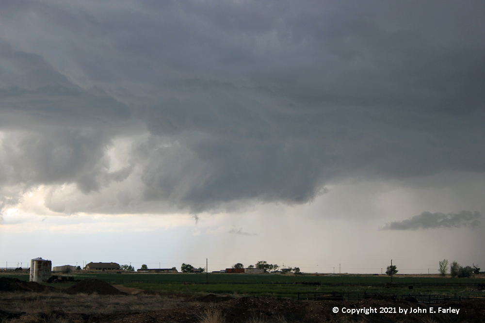
That was not the end of the chase, though. I could see that the bow-head area was moving north over Rocky Ford and figured that I could continue to follow it for a while. I headed north from the east edge of La Junta on 109 then cut west toward Rocky Ford on 266, eventually stair-stepping west and north to Ordway to keep up with the storm. Early in this phase of the chase, the same cell that produced the tornado (and also some nickle-sized hail in Rocky Ford) had an impressive structure with a hard updraft and a backsheared, knuckled anvil:
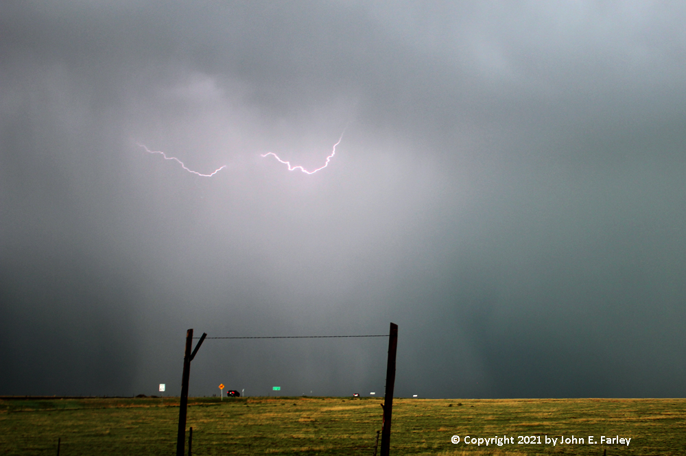
Naturally, after I turned west, a TOR warning - the first of the day, was issued - not for the bow-head area to my west, but rather for a location along the bowing line of storms northeast of La Junta. Quickly checking RadarScope on my phone, I could see that there was indeed a strong area of rotation in that area - but all I could see looking toward that part of the storm was intense precipitation, including what appeared to be some hail shafts. I headed ENE from Ordway on 96 to try to catch up with the storm, but it was not going to happen before dark. So I stopped to get some shots of the very frequent but mostly in-cloud lightning before heading south to La Junta to find a room for the night and dinner.
One interesting thing about these storms is that both of them involved bow-head mesocyclones. Both started out as rather disorganized clusters of storms, but as one storm became dominant and developed a mesocyclone, the structure quickly evolved into a bow-echo system with the rotating storm becoming the bow-head. The first storm, over the Raton Mesa, actually had a stronger rotation signature on radar, but it was the second one that produced the tornado - and also became the bow-head/bookend vortex of a much larger-scale bow echo. These evolutions can be seen in the radar loop below. The first five images show the first storm complex, near the bottom of the image just south of the CO-NM state line. The storm reaches peak intensity in the second image, at which time it coverd U.S. 64 southeast of Raton, NM with 1-inch hail. It also had its strongest rotation at this time. It is not quite a true bow-head storm yet, but by the next (3rd) image, it has made this transition. After this, the bow-head cell, which had been nearly stationary, moved pretty much due north across the state line to just west of Branson, CO, weakening after that. But the other storms down the line continued, and expanded southward. Eventually these storms became part of the second bow-echo line of storms, but I am getting ahead of myself here.
The last eight images in the loop show the evolution of the new bow echo which developed between Branson and La Junta, CO, and eventually combined with the remaining storms down the line of the first bow echo. In the first of these images, the 6th image in the overall sequence, new cells have developed northeast of Trinidad, south of U.S. 350. These cells seem to have formed on the outflow from the original bow echo. To the east, there are other storms, some of which form on a pre-existing frontal boundary extending from SE Colorado to the ENE into Kansas - the boundary SPC was looking at when they upgraded part of the existing Severe Thunderstorm Watch to a Tornado Watch. In following frames, the cells northeast of Trinidad move north toward U.S. 50, with a new cell forming over Rocky Ford initially ahead of the others. This storm quickly became supercellular, and was the one that produced the tornado - around the time of the 00:25 frame in the radar loop video. As this occurred, the disorganized cluster of cells transitioned into a bow echo, with the tornadic cell becoming the bow head. This is largely evident in this frame, and totally so in the next one, which shows a classic bow-echo structure. And from this point on, the storms in far SE Colorado and well down into New Mexico that had started out as part of the previous bow echo are now part of the new one. A very interesting sequence, that led to my first-ever bow-head tornado (even if I did have to look through a lot of nearby scud to capture it). Here is the radar loop:
Return to Severe Weather Observation Page