
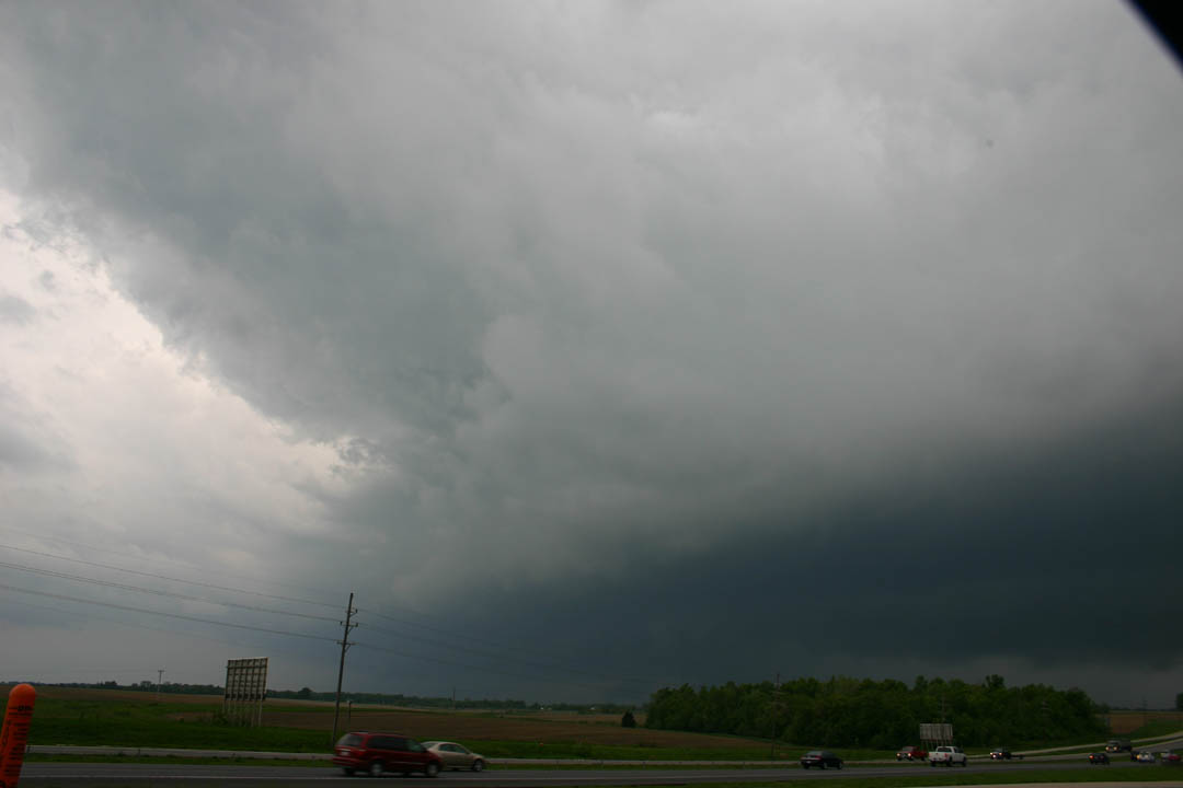
Shelf cloud near High Hill, MO
Between 8:45 and 9:30, that storm moved over about the southeast 2/3 of the St. Louis metro area, producing several tornado warnings. An intermittent tornado track occurred across Jefferson County, MO and possibly into Monroe County, IL. The storm, which had evolved into a poorly-organized HP supercell structure, developed several weak areas of rotation as it moved across the metro area, promting a chaotic evacuation of Busch Stadium, where a Cardinals game was in progress, and sending us to our basement as one of the areas of rotation directly approached our house. This was certainly more excitement than was generated by anything I saw on the chase! Fortunately, though, most of the immediate St. Louis area was spared any tornadoes, though there was scattered wind damage and power outages, and several house fires started by lightning. A few pictures and a couple radar velocity images appear below:
Shelf cloud near High Hill, MO
Next cell down the line approaches near Jonesburg, MO

Weak convection under the anvil of the approaching supercell at sunset, Granite City, IL
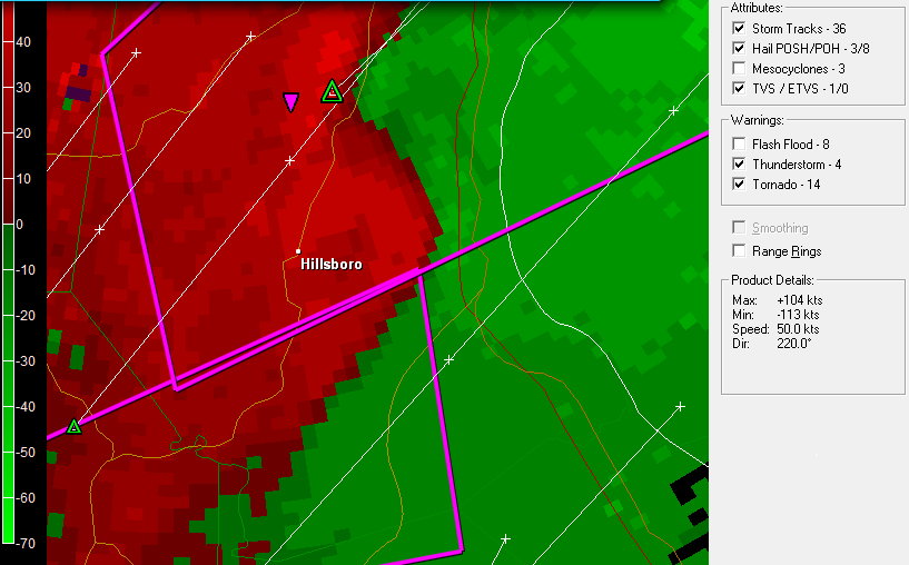
Radar velocity image, 8:38 p.m. showing strong couplet and TVS marker north of Hillsboro, MO and weaker couplet east of there. The northern couplet was associated with a tornado in the Otto, MO area that was ongoing at this time.
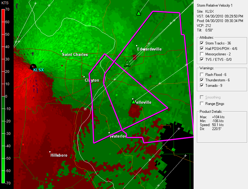
Radar velocity image, 933 p.m., showing weaker couplets south of Edwardsville and near Belleville, both near the hail markers. Wind damage occurred in Maryville, just south of the northern couplet, at this time. This couplet was moving directly toward our house, but weakened, and no tornado occurred.
Local storm reports from the St. Louis NWS can be seen here
UPDATE-May 5 - The National Weather Service has now confirmed four tornadoes with the supercell south and southeast of the St. Louis metropolitan area - one each in Crawford and Jefferson Counties, MO, and two in Monroe County, IL. The Jefferson County tornado had a path length of 17.5 miles and maximum width of 1/3 mile, and the stronger of the two Monroe County tornadoes was rated EF2 with a path length of severn miles. More info from the St. Louis NWS can be found here.
Total chase distance: 185 miles.