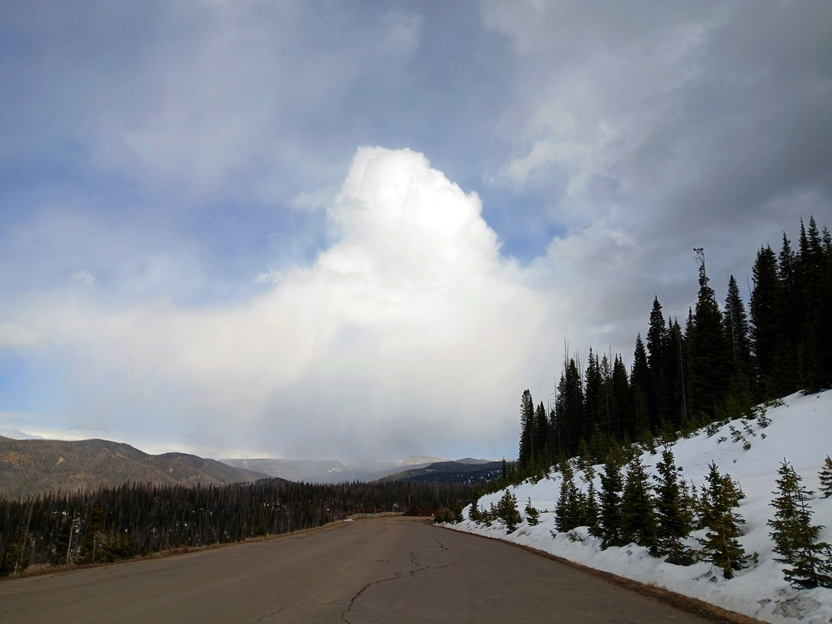
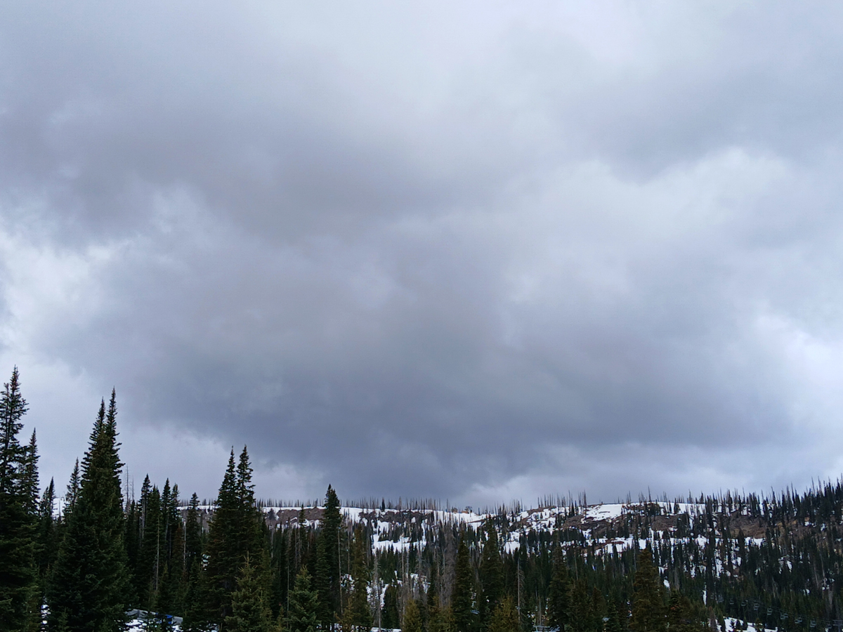
May 5 - Two near misses on thundersnow at Wolf Creek Ski area, but still some eye candy. While I was up there chasing, a strong thundersnow cell passed by 20 miles to the south in the South San Juan Wilderness - no roads there. I stayed in the mountains until almost 7 p.m. During that time there was vairable cloudiness, intermittent but mostly light graupel and snow, and numerous passing convective snow showers that seemed, on average, to be gradually increasing in intensity. But no thunder. Here are a few pictures that clearly show the convective nature of these snow showeres. All of these were taken from the Wolf Creek Ski Area parking lot:
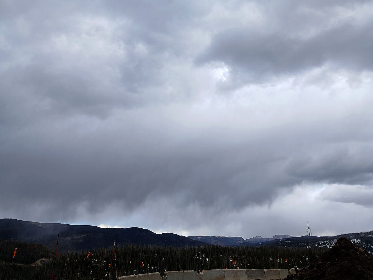
Eventually I moved down to the scenic overlook on the west side of Wolf Creek Pass. It was evident the convection was increasing, but as the time neared 7 p.m., I did not want to end up driving home in the dark with all the wild game along the way, so I headed down. Of course around sunset between 7:30 and 8, there was a major burst of thundersnow at Wolf Creek. First saw it on the lightning tracker when I got home, then I watched it on the the live stream from the ski area's webcams, and got video of a couple flashes from that, but of course managed to miss the brightest ones. So this was my second near-miss, If I had gone back up to the ski area at 7 from the scenic overlook instead of driving the other way to go home, I would have gotten thundersnow. But I would also have had to drive home in the dark in deteriorating weather conditions with the deer, elk, etc., so I am OK with my choice. Here is video of one flash of lightning from the Wolf Creek webcam:
This was the beginning of a period of heavy overnight snow that, according to Pagosa Weather's estimates, brought around 6-8 inches of snow there. Athough I missed an in-person observation of the thundersnow, I did at least get some nice pictures of the convective snow showers at Wolf Creek, even if the most intense of it was farther south when I was up there.
May 6 - Finally, I managed to get some thundersnow on video, on what was only the second day all season that I have experienced it. After the previous day's near-misses, there would be another chance for thundersnow in the San Juan Mountains northeast of Pagosa Springs. This would, for Southwest Colorado, be the second wave of the winter storm that affected most of Colorado on May 5 and 6. A strong cold front would be surging southward across western Colorado, into the relatively warm and moist air mass ahead of the front. In the morning, a broad area of rain and snow extended from west-central Colorado to the northeast toward Denver, moving in a general southeasterly direction. There was little or no lightning in the morning, but as the day warmed, it was likely to become at least somewhat more convective, and might offer up a chance of thundersnow. Most of southern Colorado and northern New Mexico were in the SPC general thunderstorm area, and local forecasts included a chance of thunder throughout the area, including in higher elevations where snow would be the precipitation type. Winter weather advisories were in effect in the San Juans above 10K feet, with 4-10 inches of snow forecast and a possibilty of 15 or more in the most favored areas. (As it turned out, significat snow, in some cases with thunder, would fall considerably below that altitude.)
Tracking radar, it looked to me like the main band of snow would reach the mountains northeast of Pagosa Springs between 11:30 and 12:30, so I made it a point to be up there by a little after 11. I was surprised by how much snow had already fallen overnight and in the morning well below 10K feet. There was snow on the ground already at Treasure Falls, and the road was very snow-covered with some slush between there and the scenic overlook at the hairpin on the west side of Wolf Creek Pass, about 5 or 6 miles before the summit. It was snowing lightly. Since the P-type was already snow (including some graupel/snow pellets), I decided I did not need to brave the nasty roads all the way up to the pass, so I stopped there. Intermittent light snow and graupel continued for more than an hour, but there was no lightning on the lightning tracker in the main band approaching from the northwest. And it appeared to be weakening as it got closer, although I knew that might be an artifact of its increasing distance from the radar and blocking of the beam by the mountains. There was a strong cell with a lot of lightning up the line north of Alimosa, and that went on to produce thundersnow around Mt. Blanca and possibly eastward to La Veta Pass. Around 12:30. the sky darkened and the snow rate increased considerably. Mostly or all ordinary snow now rather than graupel, and a lot of it. Before long the lightning tracker showed a thunderstorm popping up just south of Pagosa Springs - like the rest of the band, tracking ESE. But this was part of a new line of convection that formed on the leading edge of the band, which quickly expanded to the northeast. I decided to put the video camera on and hope for the best, and within about a half a minute I heard what sounded like a low, distant rumble of thunder. So low that I was not sure the camera got it, but it did. Somewhere between not very loud and barely audible, but it was on the video. And a few minutes later, when I checked the lightning tracker and saw several strikes in the wilderness south of Treasure Falls, with the nearest one about 5 miles south of my location, I knew that it was indeed thunder! Not very loud or impressive, but the first thunder I have captured on useable video with snow falling this season! So I avoided the skunk, since this was probably my last chance this season. And boy was the snow falling - between about 12:30 and a little before 1:30, an inch and a half of snow accumulated on my car, most of it in a period of about 35 minutes. This on top of the 3-4 inches that was already there when I got to the scenic overlook. So by when I left there, around 5 inches, give or take a half inch, of accumulated snow.
Video here:
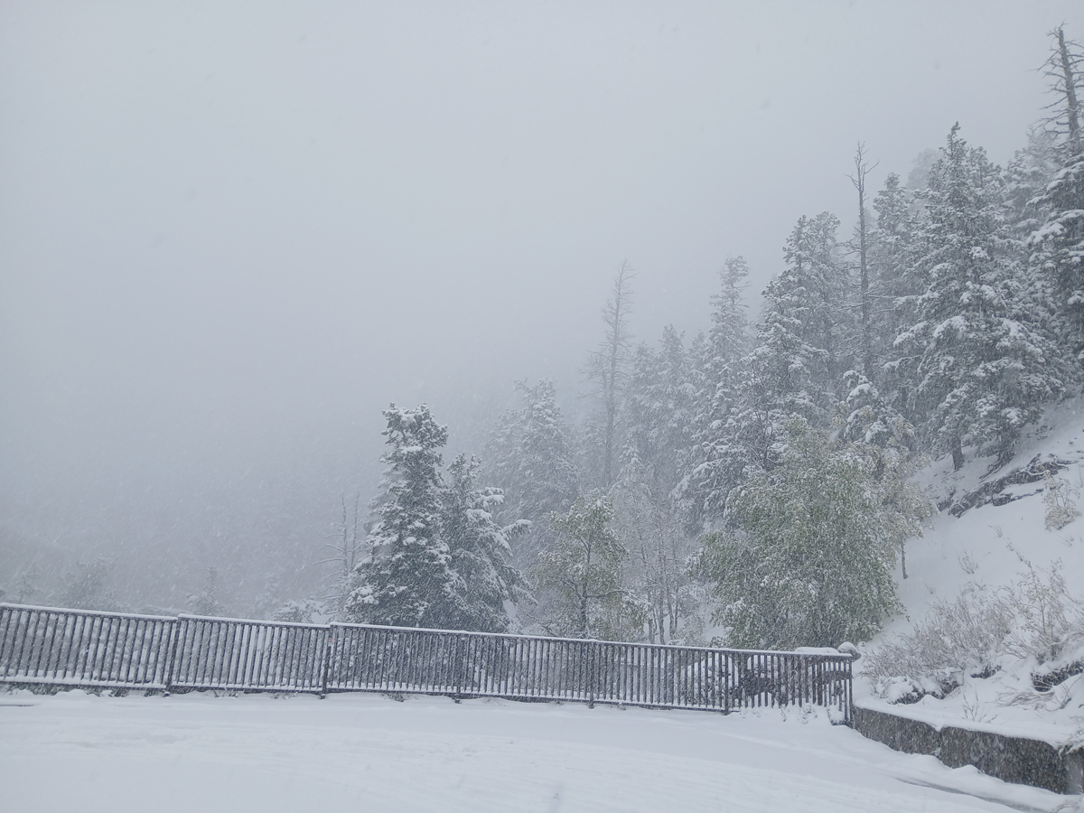
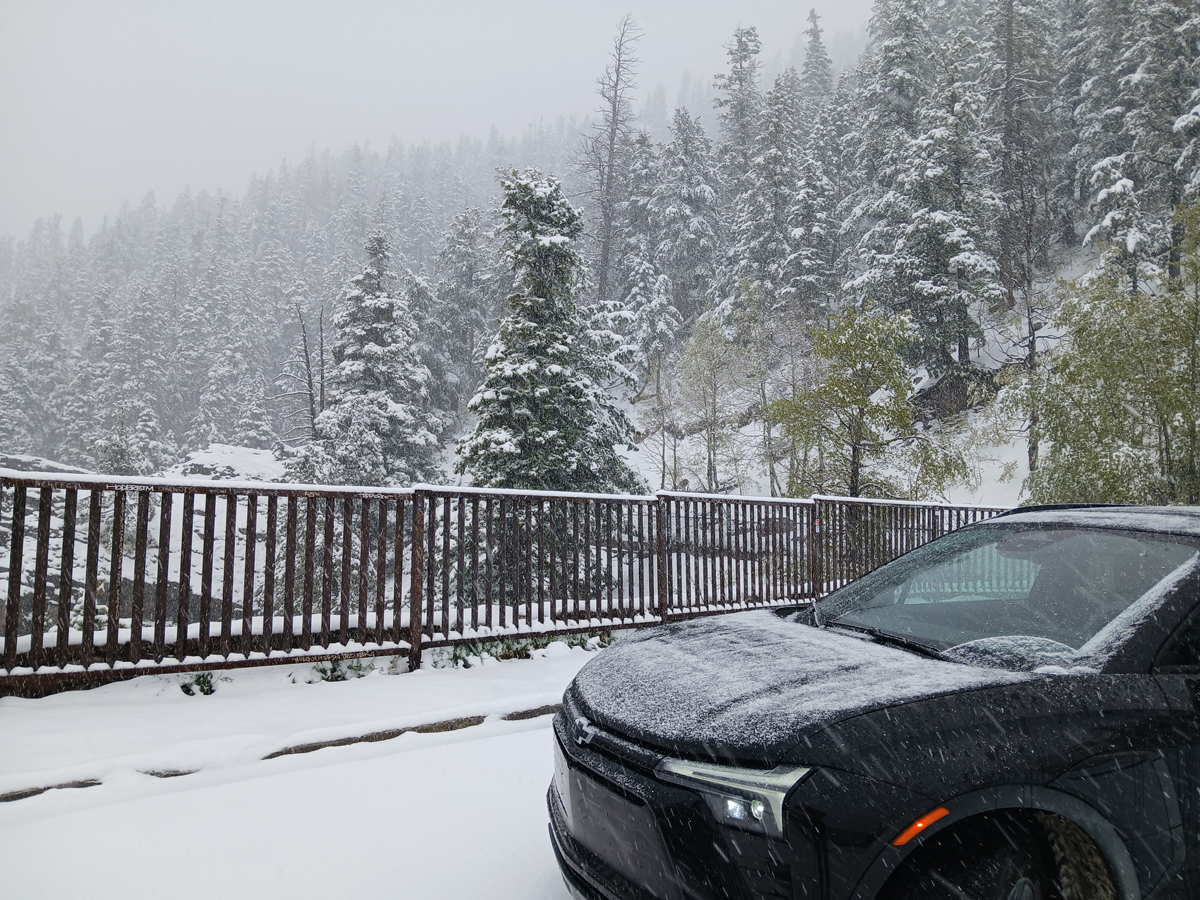
Here is a picture of the snow falling during the period of the heaviest snowfall rate at the scenic overlook:
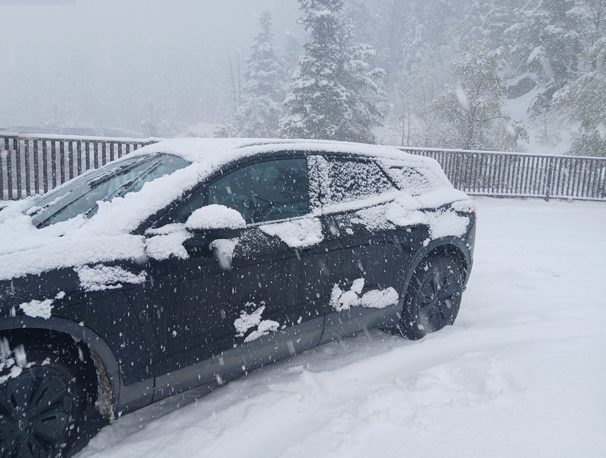
And here are a couple pictures to show how much it snowed in a short time. Just a dusting on the hood and roof of the car when the first picture was taken at 12:27 p.m., and around an inch and a half on the hood and the roof by 1:03 p.m. when the second picture was taken:
Not too long after the second picture was taken, it looked like the event was winding down, so I got out the scraper, cleared the snow off the car. and started down. The road was in even worse shape after this heavy burst of snow than when I came up, and when I came down I passed a truck partially jackknived and stuck in the uphill lane. Even at Treasure Falls, basically at the foot of the mountains, there was an inch of snow and the road was still covered with snow and slush and quite slippery. It snowed from there halfway to Pagosa Springs, where it finally had ended with partial clearing. But not without a heavy shower of graupel/snow pellets later in the afternoon around 4 at home. Since there had been yet another burst of lightning in the South San Juan Wilderness a bit earlier, I had some hope for some thunder with the graupel, but it did not happen.
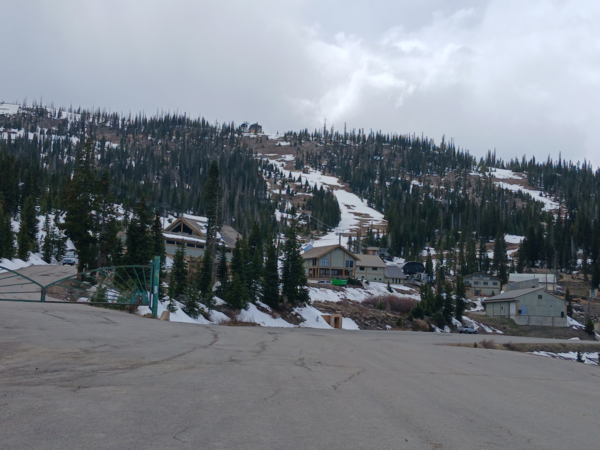
Below are "before" and "after" pictures showing that a LOT of snow fell at the Wolf Creek Ski Area - in all likelihood, a foot or more. In the "before" picture, which I took from the lower parking lot the afternoon of May 5, there is as much in the way of rocks and dirt on several of the ski runs as there was snow. In the "after" shot, pulled from the ski area webcam the morning of May 7, there is deep snow everywhere, no rocks or dirt. Also if you compare the "after" picture with the video of the snow with lightning from the webcam the evening of May 5, you can see that there is essentially n o snow on the snow cats then, but the nearest one in the "after" picture, which had not been moved after the storm, has snow well up on the sides of its treads and what looks like a good foot of snow on its back end.
Before:
After:

This was a good May snowstorm not only for Wolf Creek but for many other parts of Colorado. As noted above, locations around Estes Park were the winner with 31-34 inches of snow, and in Denver, it was the eighth-largest May snowfall on record. Definitely helpful after the exceptional warm, dry winter, but still not enough to be anywhere near a true drought-buster.