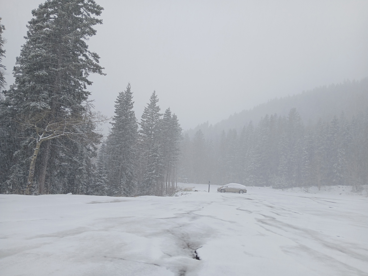
April 30 - On April 30, I headed up to Ski Santa Fe in hopes of seeing some thundersnow, but I was a little early in the storm cycle for that. However, the structure of this snow shower in the mountains shows clearly that the showers were convective:
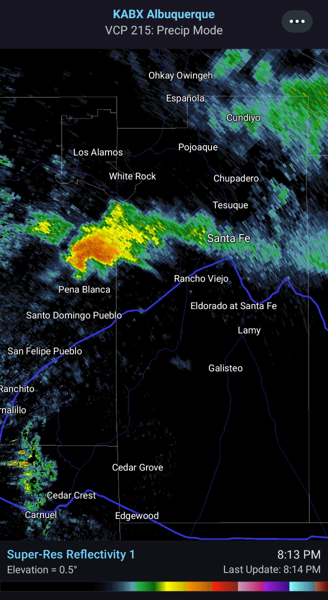
Later, well after I was back down in town, what was likely a low-topped supercell formed to the west of Santa Fe, between the Kiwa/Santo Domingo Pueblo and Los Alamos. It just more or less sat in the same place for a half hour to 45 minutes, producing heavy precipitation and some lilghtning, and gradually extending a band of stratiform rain east to Santa Fe. After that it weakened and transitioned into a band of steady rain and mountain snow, with a couple hours of much-needed rainfall (.2 to .35 inches) in Santa Fe and some snow in the mountains. The supercell formed just on the cold (east) side of a back-door cold front that pushed through gaps in the Sangre de Cristo mountains, moving to the west. There was good shear due to the upper westerly winds above the easterly surface winds associated with the shallow, westward moving front. Here is a radar image of this storm:
May 1
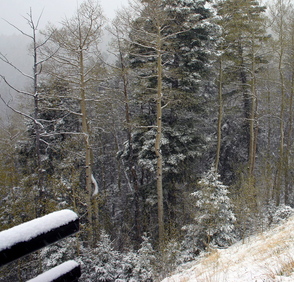
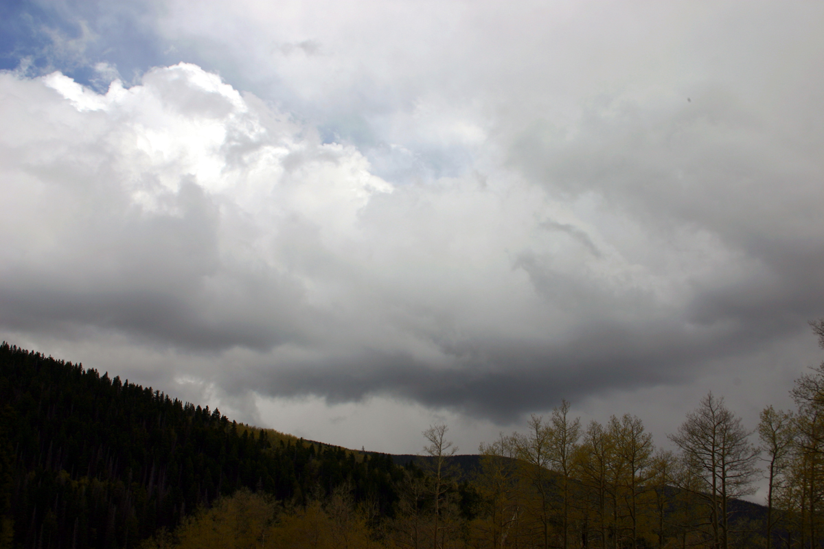
The next day, May Day, the setup for thundersnow actually looked better on the west slopes of the mountains, near Santa Fe, as the previous day's event had been in large part driven by upslope flow on the east side of the mountains and, toward evening, the effects of the back-door front. Now, on May Day, bands of convection were moving to the SSE over the Rio Grande Valley and up against the Sangre de Cristo Mountains. By around 2:30 the activity seemed to be increasing, so I decided to head up in hopes of some thundersnow. As I drove up, I saw dark, nasty-looking updraft base to the north of me and just west of the mountains, maybe around Pojoaque or Espanola, with some heavy precipitation stating to come out of the cloud bases. I did not see any lightning at this time, but going off the lightning tracker there apparently was some. I thought this would get into the mountains with snow, but long story short, although the snow became quite heavy, I did not hear any thunder. In hindsight, there seems to have been a short-lived burst of lightning as the cell first popped up west of the mountains, but that was it. However, it did accumulate 2 or 3 inches of snow at the base of Ski Santa Fe, quite a bit of it from this paricular burst, and around an inch or two at the scenic overlook a half mile or so below the ski area. Here are two pictures, one from the ski area parking lot near the peak of the storm, and another from the scenic overlook as the storm was comimg to an end: