
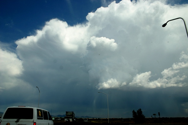
This picture was taken looking to the southeast, from along route 599, the Santa Fe bypass route, as the storm moved slowly to the south-southwest. A few minutes later, the storm developed some nice hail shafts - note particularly the one near the lower center of the picture. Then, as I got a little farther down 599, within sight of I-25, I noticed a nice haboob (surge of dust created by strong outflow wind from the storm) off to my south:

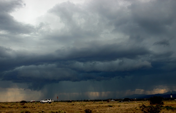
Before long dust was flying all around me, as the gust front surged west and northwest from the storm. Around this time, about 3 p.m., the storm went SVR-warned based on spotter reports of 1-inch hail in the Eldorado-Lamy area. At this time, a new tower was going up just NW of the storm, and a little farther to the NW, a line of towers was going up, with one cell already producing rain, along what appeared to be a line from about Bandolier National Monument to just northeast of Cochiti Lake. When the gust front hit this, it went nuts, exploding into a line of intense thunderstorms. I headed down I-25 and crossed under the updraft base of this developing line of storms at about La Bajada Hill on I-25, and exited at the Cochiti Lake exit, heading west about a mile where I stopped to watch the exploding line of storms, now just to my north. Soon, I was in the hail:

Most of the hail was around 1/3 to 1/2 inch in diameter, but it got heavier and seemed to be getting larger, so I decided to head back to I-25 and to back to the top of La Bajada, as the heaviest of the core was just west of I-25 heading directly toward where I was sitting. As I went back toward 25, the amount of hail decreased, but the size got a little larger, with a few dime to penny sized stones. When I got back to the top of the hill and exited at the first exit, there was less rain and hail but still a little. I had a good view of the updraft base on the back (NE) side of the storm, and was treated to a good lightning show:

After a while this part of the line weakened, so I went back down the hill to see if there was any accumulation of hail on the ground, but there was not. So I headed back to Santa Fe. As I did, I noticed a new broken line of storms north of the city. A particularly intense cell was near the foot of the mountains, and soon there was quite a bit of rising scud under this cell's updraft. To my amazement, this evolved into a rather impressive, though non-rotating, wall cloud:

This picture was taken looking northeast at the storm, which was moving about due south - which puts the wall cloud on its inflow side, right under the main updraft where you would expect it to be. Around this time the NWS in Albuquerque issued a special weather statement indicating this storm's potential for half-inch hail and 50 mph wind gusts. This storm gave me some great structure and I was lucky enough to catch some lightning with the mountains in the background:

This final storm produced an inch of rain, and probably at least some small hail, around the Espanola area and just to the southeast. Not a bad day of storm observation - 2 severe storms and a third that was very close, and all never having to drive more than 20 miles from Santa Fe.