
This HAD looked like a classic plains supercell setup, albeit in later June rather than in May as usual. With a trough and jet max coming out of the Rockies, CAPE forecast in the 4000+ range, excellent gulf moisture, and strong dirctional wind shear, it had looked for a couple days like things would come together for a significant severe weather episode in southern KS and the OK and northeastern TX Panhandles. The night before, SPC had upgraded to a moderate risk over parts of southern KS and the OK Panhandle and parts of northwestern OK. But two waves of storms from late evening the previous night to early the morning of changed all that, reducing the intensity of the setup and pushing it well to the south and west of where it was originally appearing likely. The complex of storms that gave me the bow-head meso north of Lamar, CO near the end of my chase the previous day continued southeast across much of western and southern KS, and then on into OK. Then overnight and into the early morning, another band of storms that had formed over northeastern CO continued southeast through the same general areas. These storm complexes sent their outflow well to the west and south, essentially stabilizing KS and the Panhandles and ensuring that any good setup for supercells would be well to the west and south of there, and probably. at least during the day, in areas with less instability than what had been forecast in the original target area. Early in the morning, the models were still suggesting some potential in the OK and TX Panhandles, and I initially set out to work my way south in case that verified, with southeast CO and northeast NM as possible backup plans. But it soon became evident that the models were out to lunch, because they had not picked up very well on the second wave of storms overnight and thus had the unstable air way too far northeast. Instead, the outflow boundary was already, by late morning, well west and south of that area. It extended north to south across eastern CO and northeastern NM, then southeastward into TX. The southeastern part of it was still surging south, getting well south of I-40 before noon, while the part over NM and CO was moving more slowly to the west. In their 1630Z update, SPC essentially chucked out the models and made their forecast based on surface observations and the position of the outflow boundary. This was consistent with my thinking, focusing the greatest severe potential in CO west of the outflow boundary, although I also thought there was some potential in northern NM west of it. It seemed like the most likely place storms would start would be along the front range mountains, then moving east or ESE onto the plains where there would still be conditions favorable for severe weather between the mountains and the outflow boundary. The upper disturbance/jet max and perhaps directional wind shear would still be there, and instability, though not as great as earlier forcast, would still be plenty for the eastern plains of CO and NM, with CAPE no longer in the 4000 range but still likely around 2000, plenty for this higher-elevation area. And for me, I would not have to drive as far and would finish the chase closer to home. So I was OK with the new situation, though I know many KS and OK chasers were not.
The chase:
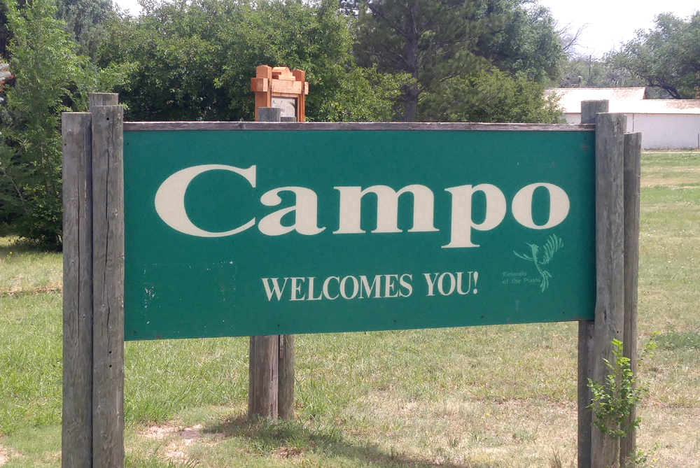
Figuring I would be chasing either in the Panhandles or in CO or northern NM, I knew I would not have to go too far from my overnight stay in Lamar, CO. I initially repositioned south to Springfield, CO, to wait there for more data and decide what to do. Had time for a leisurely lunch and a drive 18 miles south and back to check out Campo, CO, where I had never been, having missed the big day there some years ago. Good to see they are Storm Ready! By around 2 or 2:30, it was becoming evident that the way to go was east on 160 toward Trinidad. Storms seemed likely to fire near the mountains and move onto the plains in that area, and I would also have options to cut south into NM.
3:50 - southwest of Kim, I can see a storm - likely an LP supercell, to my southwest, coming off the mountains SE of Trinidad.
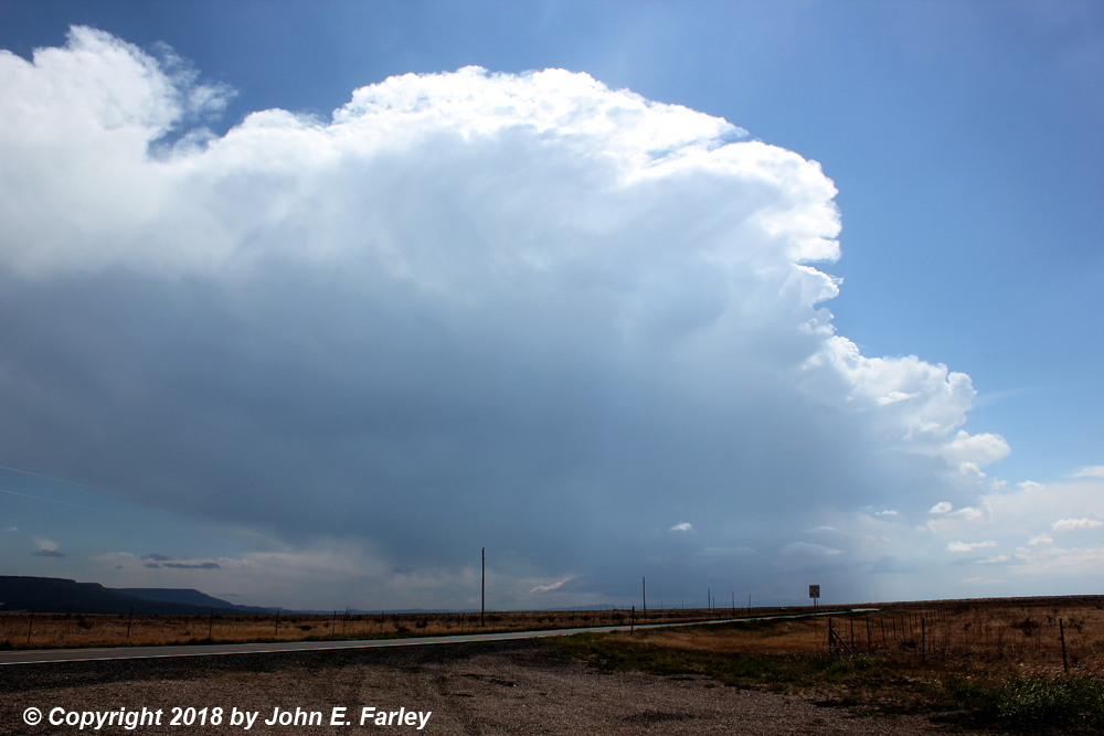
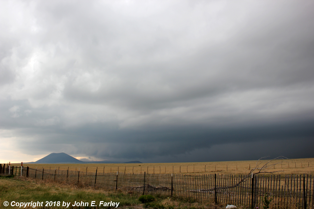
4:00-4:15 - The storm comes into better view as I head west and it moves east. Definitely has the appearance of an LP supercell, and looks decent on radar, too. The storm at this time is approaching Trinchera. I decide head south toward Branson, CO on CO route 389.
Here is a view of the storm around 4:15, looking west from route 389:
4:20-4:35 - I intercept the storm near the north edge of Branson. As it approaches, it displays a long beavertail and some decent LP structure. Both the appearance of the storm and its radar return show clearly that the storm is an LP (low-precipitation) supercell. It drops 1/3" hail at my loction, which grows to 1/2". Also forms a tube-like feature, but it was not rotating as far as I could see, and did not appear to be attached to the cloud base, at least when it first formed. Here is a picture:

By now, the storm seemed to be weakening, but it was still producing hail and periodic rumbles of thunder from in-cloud lightning. By 4:30, it is becoming evident that a new storm is forming farther west, near Trinidad. And indeed, the NWS in Pueblo issued the first of several special weather statements regarding this storm a few minutes later.
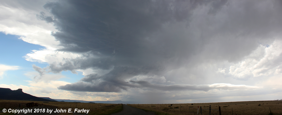
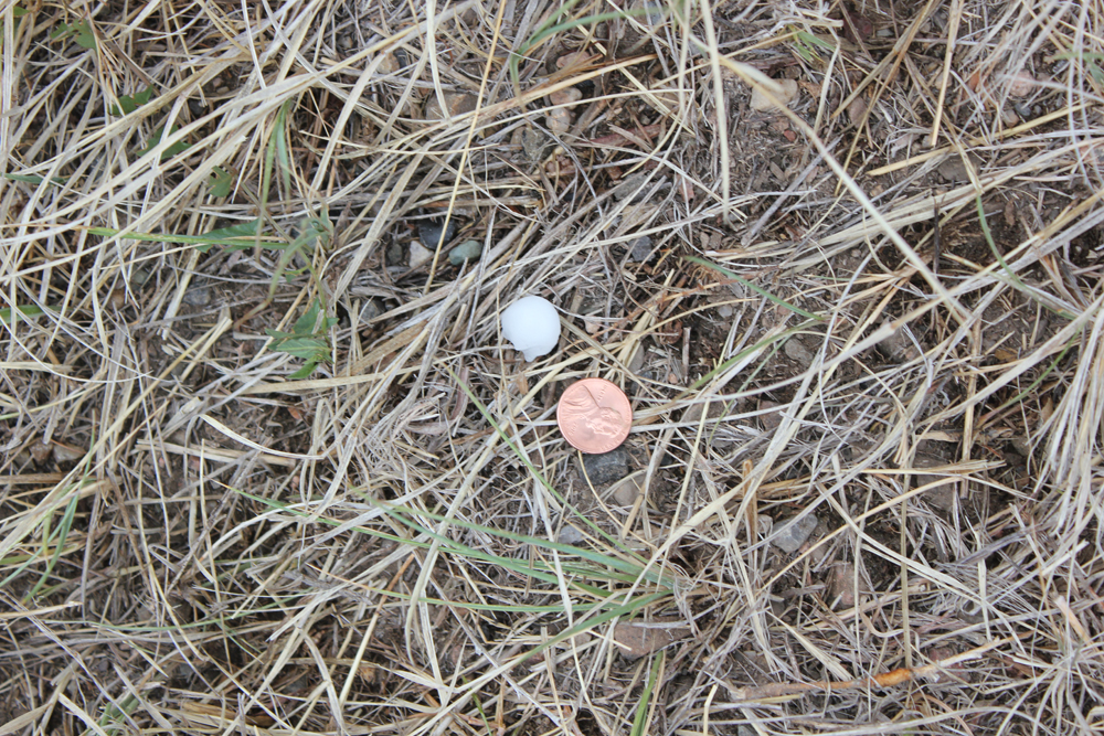
5:00-5:20 - After investigating hail on the ground just north of Branson, and finding stones up to slightly smaller than dimes, I head west on the gravel road toward Trinchera, CO to intercept the rapidly strengthening storm S or SE of Trinidad. By arond 5:00 p.m., this storm definitely has the look of a supercell, again with a long beavertail:

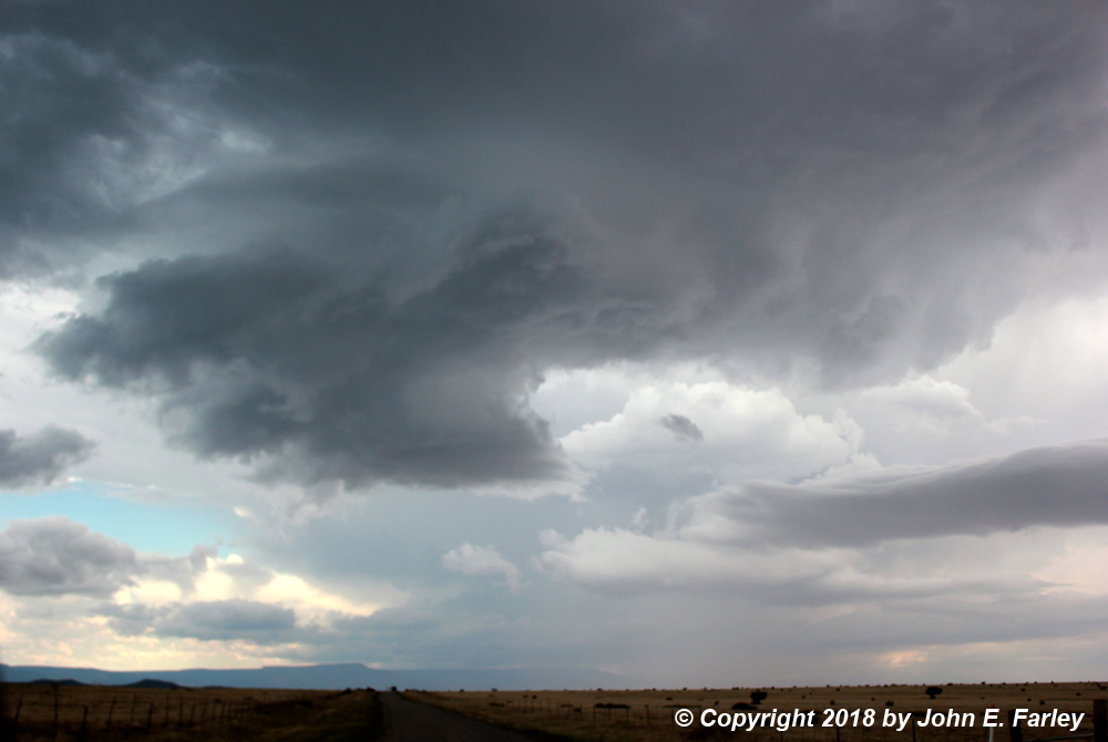
Around 5:05 p.m., it develops a menacing wall cloud which appears to have some rotation:

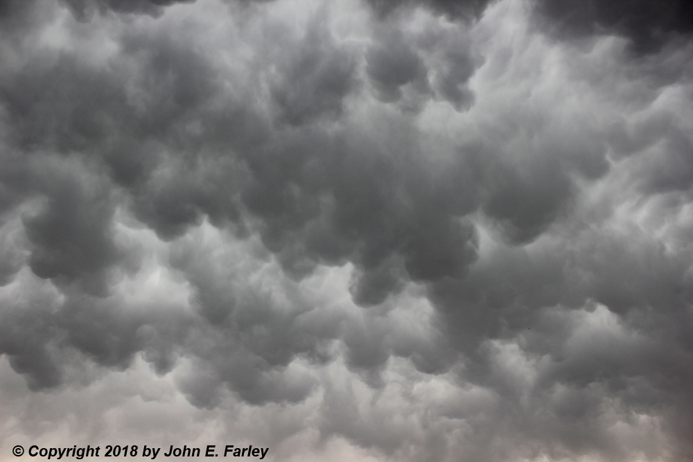
Also shortly after this happened, though I did not immediately hear about it, a SVR warning was issued for northeast Colfax County and northwestern Union County, NM based on radar indication of severe wind and hail near Trinchera. Later analysis of radar confirms a sharp southward turn of the storm between about 4:50 and 5:10, moving SE into New Mexico south of Trinchera. The radar also shows rapid intensification. Likely because of this change in movement, the wall cloud becomes hidden by rain around 5:15, and I along with other chasers bail east to Branson then south into NM on 551. Just NW of Branson I stop briefly to photograph mammatus in the anvil above me. Around this time also, positive CG bolts begin to occasionally zap down from the anvil, a pattern that would continue for the next half hour or so.
Around 5:25 - Bailing south on NM 551 in a little hail, mainly small just ahead of the core, basically trying to cross the Raton Mesa ahead of the storm, I see a tubular structure that looks like a funnel cloud, just to my west and almost above me. I manage to grab three pictures through the windshield and side window. At this time I was nearly sure it was a funnel, and pretty close. Here are a couple of the pictures I managed to get:
But two minutes later, once I am safely ahead of the storm and stop to look back at it, I see that there are several such features and that they are more horizontal than it looked like from underneath, and that they seem to be wrapping around the meso:
After discussing this with other chasers, I am now pretty sure that the original feature I saw was not a funnel but rather some striation feature wrapping around the meso. By now, another cell has formed just west of the one I am on, although I did not know that yet.
5:30-5:35 - At the intersection of NM 551 and NM 456, I look back NW at the meso, which now takes on a stacked-plate appearance:
Later radar analysis now shows that this cell has taken a turn back to the east (with eventually a turn to the northeast) while the cell just to its west dives SE and rapidly intensifies. Later radar analysis, discussed below, suggests this was not a true split but rather more like a handoff to the next cell, with that one very quickly becoming the dominant one.
5:40-5:50 - I head southwest on 456 to Folsom, NM, with the idea of then heading SE toward Des Moines, NM to get a view of the southeastward moving storm (I thought) from the southwest, the ideal viewing direction for that movement. But I now become aware of the new cell now SW of the original one, with a small gap between the two (with a nasty looking updraft base), and hail again, and a little bigger now in Folsom, with a few stones around quarter sized mixing in. I think about trying to get further SW to really be southwest of the whole storm, but the hail intensifies just ahead of me so I turn SE on NM 325 and race toward Des Moines to get ahead of the storm.
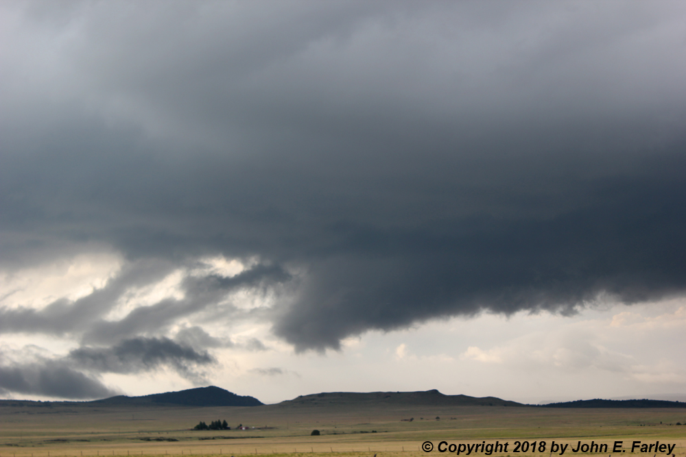
5:55 - 6:10 - When I got to Des Moines, I went a little west on U.S. 64, moving back and forth a bit during this period to watch the storm. A second SVR warning is issued at 6:09 p.m. shortly before the earlier one would have expired. I first see the wall cloud (of what was the newer storm just SW of the original one, which has now turned further northeast and weakened) just to the north of the Capulin Volcano. This wall cloud moves southeast to a position just to my north and just NW of Des Moines, and becomes a real ground-hugger. Looked like it stretched all the way to the ground at times, though it probably did not as there was some higher terrain between me and the wall cloud a few miles to my north. At 6:00 p.m., 1.5 inch hail is reported 4 miles NW of Des Moines. Here is a picture from a few minutes after that, looking north from a little west of Des Moines:
Around 6:10, I briefly work my way a mile or two SE of Des Moines with the storm, but it is looking less impressive, and yet another storm has formed just to its west.
6:15-6:20 - The new storm, again just north of the Capulin Volcano, forms a small lowering and what appears to be an RFD cut. But it does not look as strong as the storm just to its east, and the two storms seem to be merging. The feature becomes less evident, and clouds form around the Volcano, creating almost the appearance of an eruption at times. But of course it wasn't, and the storms seemed to be going into a messier mode. By around 6:30, I decide to head to Raton to get a room for the night.
Around 7:10 - Southeast of Raton on 64, I see new towers ahead. These are storms developing near the tail-end of the main line of storms along a cold front moving in from the northwest. (Storms associated with this front produced a lot of wind reports across eastern CO and western KS, but I never really considered chasing them because they were strongly-forced by the front, multi-cellular, and linear for the most part. An exception would be a couple of storms in this MCS that became supercellular around Colorado Springs and later and more briefly around Trinidad, but I felt the better play was to go after the more isolated storms ahead of the main line so never really considered going after these.) But now the tail end of the line was getting near me; it was northeast of Raton and I was southeat. I saw some ragged, rising clouds under the updraft base, pretty much everywhere you could see under the updraft base between a couple mountains to my northwest or north. I got a couple pictures and some video, and continued toward Raton.
7:25-7:30 - Closer to Raton, still looking at the same part of the line of storms, it becomes evident that the feature under the updraft base was a shelf cloud. I am much closer now, as a distinct shelf cloud forms near the southwest end of the main line. Pretty bright under/behind the shelf cloud, but it is evident from its obscuration of the mountains farther north that precipitation, probably including at least some small hail, is falling back in there. Here is a picture of the shelf cloud:
Later examination of radar confirms rapid intensification of a cell at the southwest end of the line, and another strong cell just up the line from it. New SVR warnings are issued, and again the area from Trinchera to Des Moines is in the line of fire.
9:00 p.m. - After dinner in Raton, I photograph a storm to my south and a nearly-full moon. This storm is a new isolated cell that has formed basically south or SSW of the tail end of the line, probably supercellular for at least a while, and both it and the line to its NNE get new SVR warnings. Here is a picture of this storm and the full moon, along with the lights of some Raton businesses:
While this day was not as robust as it had looked like a couple days earlier, these storms were among the most photogenic I have seen this year. Indeed, probably more pictures in this chase report than any others I have done this season. Including both LP and classic supercells and, as discussed more in the radar analysis below, some fascinating storm interactions. So all in all, a very good chase day, and closer to home than I had expected.
Radar analysis:
I was intrigued by some of what I saw on this chase, including especially the funnel look-alike and the seeming handoff to a new storm that happened around the same time. I did notice a little of this on radar during the chase, and thought there may have been a storm split while I was between Branson and Folsom. But the meso that produced the interesting striation features did not seem to be anti-cyclonic, and in a true storm split it likely would have been. So I decided to download some radar images and make a loop, and that was very revealing:
Video of radar loop:
Several interesting things going on in this loop, which runs from 2154Z (3:54 MDT) to 0033Z (6:33 MDT). In the first five frames, you can see the LP supercell tracking east just north of the CO/NM line, through the Trinchera and Branson areas. The annotation on the fourth frame notes the formation of the new supercell farther west near Trinidad, although you can see the very beginning of its development a couple frames earlier. By the 7th frame (2237Z or 4:37 p.m. MDT), the new supercell, now east or SE of Trinidad, is becoming quite strong, and the first of a series of special weather statements and eventually SVR warnings is issued. Also around this time a new cell forms just west of the main one, but it does not do much for a while. Over the next four frames or so, the main storm rapidly intensifies and takes a turn to the southeast into New Mexico. This corresponds to the time in which the wall cloud appeared southeast of Trinidad. By 2318Z (5:18 MDT), the new storm just to the west of the main one is intensifying and the movement of the main storm turns back to the east again. It is just a few minutes after this, 5:24 p.m. according to my camera's time stamp, which is very close, that I observed the striation features, the first of them being the feature that I initially thought was a funnel cloud. Thus, this definitely happened at a time when the two nearby cells - the one that up to then was the main supercell and the new cell just to its west - were interacting with one another. In the next radar frame, just one minute after I observed the aforementioned features, the up-to-then main cell is starting to turn a bit to the northeast and the new cell that formed to its west is surging southeast into NM, much like the other one had done earlier. (This is the frame with the annotation, "Wrapping feature occurred at this time.") By the next frame at 5:32 p.m., the new cell to the west has become dominant as it continues its southeastward surge further into NM, with dramatic strengthening, while the formerly-main cell is crossing back east into Colorado. This is when I saw the "stacked plate" meso - the same one associated with the funnel look-alike - looking northwest from the intersection of routes 551 and 456.
The radar imagery during this time period confirms several things to me. First, this was NOT a cell split - the two cells were separate from the time the second one formed. Thus, I was right in thinking that the meso of the original one was cyclonic the whole time. Second, there seemed to be something of a handoff of the main energy from the original cell on the east to the new one on the west. Third, and a bit more speculatively, there may have been a Fujiwhara effect going on between the two cells, as they for a short time started to rotate around one another, with the western cell turning to the southeast and the eastern one to the northeast. Alternatively, it may have just been a case of the eastern one becoming more influenced by the upper winds as it weakened. Either way, once this change in the movement of the two cells had happened, the western one, like the right split in a true cell split usually does, became the dominant storm, and surged southeast toward Des Moines producing severe hail. Yet another cell formed to the west of the new one and also intensified, but it never became dominant. Clearly there were some very interesting storm interactions going on here! One other thing I think was very likely is that some of this ws influenced by terrain. When the handoff and possible Fujiwhara effect occurred, the storms were crossing the Raton Mesa, an area of high terrain that extends eastward into the plains from between Raton, NM and Trinidad, CO. It often plays a role in helping to trigger strong storms in this area, but in this case I think it also probably affected some of the specifics of the storm interactions that occurred. I was literally in a canyon near the center of the mesa when I observed the funnel look-alike/striation features. Yet another interesting element in a very interesting chase day.
Chase distance for the day: 285 miles.
Total chase trip distance, including return home the next day: 924 miles.
Return to 2018 Severe Weather Observation Page


