
Lots of moisture and instability would be over much of New Mexico after a back-door cold front had moved across the state from east to west over the past couple days. Now gulf moisture was being pumped in from the southeast, and the air mass was warming. An upper low to the west, not moving much, wouid provide some southwesterly upper winds, though the strongest wind fields would be west and north of the instability over New Mexico. The transition from the moist, unstable air over much of New Mexico to dry desert air to its west was relatively diffuse and over western NM/eastern AZ. Thus, most of New Mexxico was in moist unstable air and had some potential for thunderstorms. Severe weather was possible in most of the state, but I thought the best chance would be in upslope flow near and east of the central mountains in the southern half of the state. The greatest moisture/instability would be central and southern NM, with surface flow somewhat more SE as you go south (more of a southerly flow farther north). Thus, directional shear would be better to the south. Dewpoints would be in the 50s and 60s, with CAPE in the 1500-2500 range forecast, with models showing the best instability east of the central mountains. The HRRR model fired lots of storms both sides of the mountains, but the strongest, most isolated storms looked to be near and east of the mountains. (As it turned out, it took much longer than the HRRR predicted for storms to develop here; basically it did not happen until the broken line of storms that developed early west of the mountains moved east, crossing the mountains in the late afternoon/early evening.) I initially targeted the area around Roswell, though when I got on the road I realized it was a little farther east than I thought and therefore a little east of where I wanted to be.
The Chase
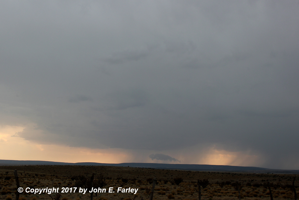
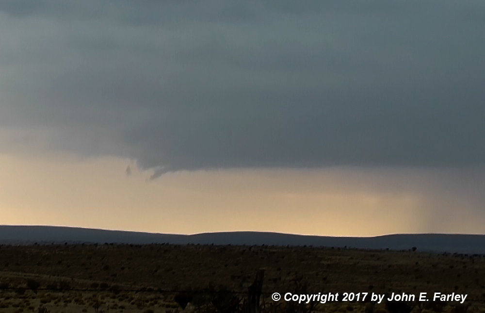
I was out the door from Santa Fe at 10:10 a.m. with a target of somewhere around Roswell. I ended up getting there around 2:00, but realized by then I needed to be at least a little west of there for where I expected storms to fire. The HRRR still showed storms firing soon around Ruidoso/Lincoln. Up to now, all the substantial storms were west of the central mountains, with a number of SVR warnings there. Hail and flooding did occur with a SVR-warned storm in Albuquerque, and storms were starting to cross the mountains up there. But still west of the mountains where I was. I adjusted west to the hwy split between 70 to Ruidoso and 380 to Carrizozo and played around for a while with storms firing just west of there. This is where the HRRR predicted a big storm (and was consistent in that through many runs). But all the storms there were junk - a little tower would go up and immediately fall apart. Saw the Mississippi State University chase van in this area, similarly waiting and trying to decide what to do, I guess. After fooling around with these till a little after 3:30, I decided to move west toward Carrizozo. If anything went in this area while I was on the way there, I could get it, but I could also shift to the other storms if not. I watched both groups of storms until I got to Carrizozo around 4:30, still undecided. One storm to my south looked visually good around 4:20, and I thought about going after it. But it still looked poor on radar, and looked less good visually after a few minutes. Since the HRRR had predicted big storms in this area as early as 1:00 p.m. and nothing but junk had happened, I thought I should cut my losses. After all, there were strong storms now crossing the mountains west and north of my location. Also on the latest HRRR, nothing was predicted anywhere south of its predicted Ruidoso-area storm, and that was pretty much the southeastern end of the severe thunderstorm watch that had been in effect since around 1:00. Interestingly, SPC issued a mesoscale discussion when the storms initiated west of the mountains in the late morning, mentioning only a 20 percent of a watch in that area, with one more likely to the SE later. Then one was issued, pretty much for that discussion area, including Ruidoso and Carrizozo but not Roswell, and extending all the way up to the CO state line on the west side of the central mountains, including Albuquerque and Santa Fe. No more MDs were issued for NM after that until much later, while I was on my storm, mentioning a 20 percent chance of a watch to the east and south of the current one. Then less than an hour later, they issued a new watch there. Go figure - 2 for 2 on a 20 percent chance of a watch.
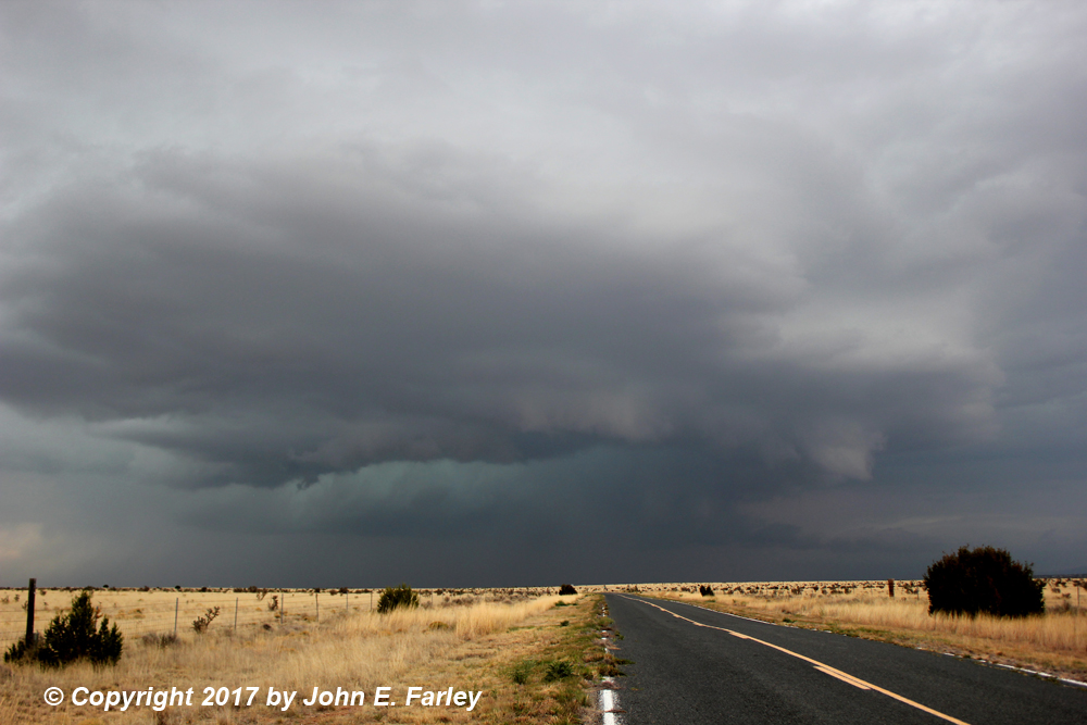
Anyway, at 4:30 I decided to cut my losses on the Ruidoso/Lincoln junk and head for the main line of storms. (There was, later, a nice supercell in that area, but not until an hour or so before sunset, and that area is mountainous and hard to chase, so I do not regret my choice). Now there were some strong storms, rather isolated, about 40 miles to the WNW of Carrizozo. They were near highway 380 that crosses the mountains west of Carrizozo, but I figured if I went that way, the storms would move NE away from me and I would be stuck with no way to follow them. So I went northeast on route 54 instead, figuring to cut northwest from there to intercept the storms. The road to Claunch and Gran Quivira, NM route 55, looked like it would get me closer to these storms, so I took that. This would be somwhere around 5 p.m. I thought the storms would drift slowly to tne NNE and pass west of Gran Quivira based on how they had been moving, but there was eventually a rightward turn that allowed me a much closer intercept. By around 5:15, the main line, to the NNE of the cluster of storms I was interested in, got SVR warned, and my road afforded a view of both that line to my N and NE and the cluster of storms I was interested in, to my SW. Data was intermittent, but when I had it, the radar appeared to show the storms to my SW intensifying. I stopped several times south of Claunch between 5:15 and 5:40 or so, watching and photographing both the SVR-warned line to my NNE and the approaching more isolated storms to my SW. From around 5:45 through 6:45 I made a number of stops at the west edge of Claunch, a few miles north of there, and a few miles south of there, as the storms congealed into one strong supercell. Around 5:50, by which time a special weather statement has been issued for the storm, a large scud cloud formed near the ground under the updraft. This merged into the base of the cloud and became a wall cloud by 6:00 p.m.:
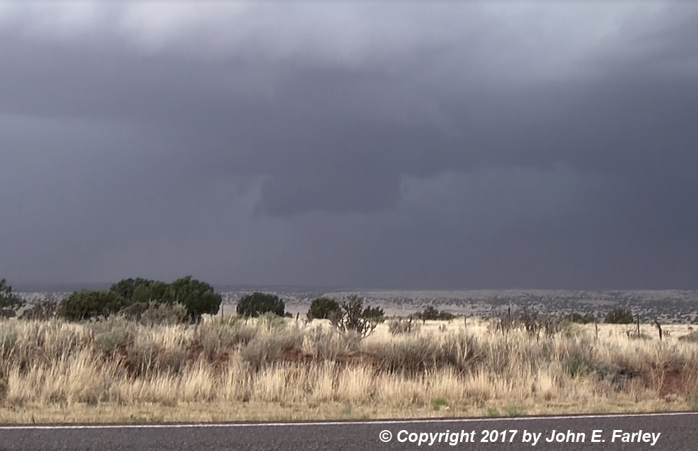
Between then and about 6:30 the storm cycled a number of times, with the original wall cloud dissipating or disapparing in the rain while a new one formed to its southeast. There also appeared to be one or two possible funnel clouds around 6:05 or 6:10, but I was too far away to tell for sure. At 6:15, the storm went SVR warned, first of several it would get.
Here are a few pictures from between 6 and 6:30:


Shortly after I took the last picture above, a large dust cloud went up to the left of the wall cloud, eventually reaching maybe halfway up to the cloud base. I do not think it was a tornado, because there was no visible lowering directly above it - again it was to the left (east or SE) of the wall cloud. And I was too far away to tell whether it was a dust plume from outflow wind (RFD?) or a gustnado, though the shape of it looked a little more like the latter. It lasted maybe 2 minutes or so; I do have it on video. Here is a frame capture from that video:

By around 6:45, the storm was moving over Claunch; by then I had repositioned a few miles south of there, and was within a mile or so east of the meso:

After getting this picture, I bailed southeast as the RFD blasted me with dust and tumbleweeds. Probably sub-severe wind, perhaps in the 40-50 mph range, though it may have been stronger in nearby areas where big dust clouds were kicked up. While watching the storm and as I was bailing southeast on 55, 3 pronghorn (first one, then later two more) crossed the road right in front of me. They seemed freaked out by the storm; one ran right in front of me. The first one dug under the fence rather than jumping over (they can jump fences, but don't like to); amazing how fast it got under the fence.
As I got south to where the road turns east to go back to 54, the storm took on HP character. As I was heading east, it formed yet another wall cloud shortly after 7 p.m., but by now the storm had fully transitioned to HP. By the time I get to 54, I am quite a bit south of the storm, but since that road goes NE, I figured I could catch up to it. I did pretty easily, and now for the first time since I got on this storm I was seeing quite a few chasers. It was evident the storm was going to cross 54, so I and the others worked as close as we could without going into it. It formed yet another pretty impressive wall cloud around 7:20, but this one wrapped up in rain and hail almost immediately. Around 7:35, yet another lowering formed on the flanking line, although the main meso seemed to be totally wrapped up in rain and hail to the north. Now the only way to see into the notch would be to get in the direct path of the storm, and I was not about to do that. Instead, I drove up within a mile or two of the core and stopped to let it cross the road in front of me. This was round 7:45. Once the main core of the storm had crossed the road, and only the lighter precipitation to its southwest remained ahead of me, I pushed into the storm, mostly by now figuring the chase is over and time to try to get a room, with Vaughan the only real possiblity, still 70 miles or so to the NE. As I got closer to Corona, the traffic slowed, and an accumulation of hail appeared at first on the sides of the road, then soon on the road itself. Intermittently for probably ten miles there was hail on the road, with some on the sides pretty much the whole way. By around 8:10, the hail was accumulated to a depth of about 2 inches on and along the road, and I stopped to take some pictures:


In the second picture, you can see the storm retreating to the east in the background, looking down a side road that nobody has ventured down since the storm. The biggest stone I saw here was about nickel size, but since it was still raining quite a bit, I did not spend a lot of time looking around for hail sizes. This was about 4-5 miles SW of Corona; others reported hail an inch in diameter there, and as large as 1.25" closer to Corona. There were also reports of hail accumulations of 3-6 inches along 54, but it did not look that deep to me.
After this, along with a couple spots with some water over the road, the truck drivers became extremely cautious, creating effectively a moving roadblock the whole way from where the hail started up to where 54 merges with 285 near Vaughan, a distance of about 45 miles. Rain fell the whole time, very heavily at times and lightly at others. And CG lightning zapping down as well, very close by the time I was near Vaughan. I had hoped to get a room for the night there, but the entire town was dark, apparently without power due to the storm. So I decided to return to Santa Fe, which worked out fine because the next day turned out not to be a real chase day, though there were some strong storms in the immediate Santa Fe area.
Here is a map showing my route during the active phase of the chase, along with the track of the storm and the approximate locations of storm features I observed:

Total chase distance 533 miles
Return to 2018 Severe Weather Observation page