
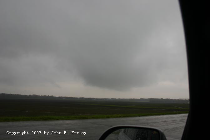
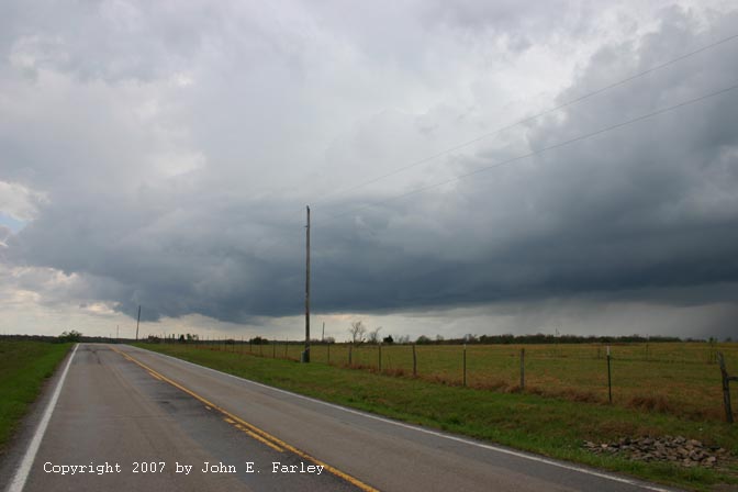
As I expected, I encountered the next batch of storms during the early afternoon between Bartlesville, OK and Coffeyville, KS. Actually there were two clusters of storms nearby as I crossed from KS into OK at Coffeyville, KS, one to my east and one to my SW. Both clusters of storms were SVR warned, and the weather radio was mentioning the presence of mini-supercells. I decided to go for the western cluster, mainly because I was in better position for it, but also because it was more recently warned. I followed this cluster storms northeast from near Delaware, OK to a little west of where routhe 10 crosses the Nowata-Craig Co. line. The storms were backbuilding to the SE and were alligned roughly along a NNW-SSE line. This picture is about as close as I saw any of these storms get to looking like mini-supercells - mostly the line was backbuilding too fast to get much in the way of discrete cells, though I believe the storms may have started out that way. Due to the backbuilding to the SE, I had to constantly shift east to stay ahead of the storms. At several points I got into the leading edge of the precipitation, and where 10 turns east a couple miles north of Steamboat Mound, I also got a little pea-sized hail, even though only a few big drops of rain were coming down at that location. This picture was taken looking northwest just before that happened (though the precip moved into my location from the SW, from a newly developing part of the storm). I stayed ahead of the main precip core, though, until I noticed that the next line of storms to my east was looking really good. So I made the decision to break off the western storms and target the ones to the east, which were in any case moving into warmer, less worked over air.
I headed east to Miami then blasted up I-44 to Joplin. The cell shown above had moved north of Joplin, and a new cell formed to my southeast. I was able to poke under the line between the two cells, and then through the later afternoon hours I followed this storm and others that formed down the line from it from Joplin to Springfield, MO, finally toward sunset ending in the narrowing area between this line of storms and the mini-supercell north of Springfield.
Some of the storms in the line of storms that I chased from Joplin to Springfield, through the Pierce City and Monnett areas, had the appearance of HP storms embedded in the line. Basically, a lowered area - I guess you could call it a wall cloud - would form under an updraft in an area of RFB between two areas of precipitation. Then precip would fill in quickly behind it, and it would either wrap up in rain or morph into something more of a shelf cloud. Here is one such feature over Joplin, on a storm that went SVR warned around the time I took this picture:
This feature formed just after I had driven under the updraft between the two cells. This feature had looked better a few minutes earlier, while I was getting off the freeway and trying to find a safe place to stop, but by the time I got where I could stop and get a picture, it was already wraping up in rain.
Here is another that formed a little farther down the line, about over Pierce City:

This time the area behind it filled in, and it became elongated and more of a shelf cloud feature. But the northern end of the feature remained lowered quite persistently as the storm moved toward Springfield. Somewhere east of Monett, I think somehwere around Aurora, it formed this:

Contrast slightly enhanced
This may have been a brief needle funnel, but I think more likely it was a scud finger - I could not tell for sure. But note also the inflow feature on the right side of the parent lowering. This was associated with the area where the initial lowering formed and which was persistently lowered for what I would estimate to be about 20 minutes. A shelf-cloud type feature extended south from this lowering at this time. I think this feature suggests something of an HP supercell structure embedded in the line, much like the lowering I had seen earlier over Joplin.
By this time the mini-supercell north of Springfield was really getting my attention, and I made the decision to break off the line I had been observing and head north toward the mini-supercell. As Dan Robinson mentioned in his chase report, this cell did have a very persistent wall cloud. The wall cloud dissipated shortly after I caught up with the storm near March, MO, but I did see some rotation just before it dissipated. Here are 3 pictures of this low-topped supercell:

Taken from somewhere around Aurora, MO, looking NE.

Contrast slightly enhanced to better show features. This was taken from north of Springfield, along route 65.

Taken from same location as above, but zoomed.
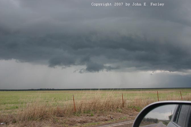
As I was driving toward the storm on 65 after taking the pictures above, it formed one of the tail clouds Dan described in his chase report. It briefly had the appearance of a funnel, but it was at about a 45 degree angle and was not rotating, so I agree with Dan that this and other features he observed earlier were inflow tail features, not funnels. I see there were a couple funnels reported north of Springfield at a time when I was too far from the storm to see them, but based on Dan's report and what I saw later, it is possible these reports were erroneous. OTOH, the wall cloud was definitely rotating at times. Once I had caught up with the storm near March, it weakened rapidly after producing the brief rotation I observed near there. I think partly this occurred because it was starting to merge into the main line of storms, which was now rapidly approaching from the West. The main line was moving northeast, while the isolated mini supercell was moving about due north or perhaps even a little NNW. I poked just west of Buffalo to get a few final pictures of the approaching line of storms, which was again looking pretty healthy and like it might have a little hail in it:

All in all, not a bad chase day; much better than my bust the previous day. And the second day this season that I have been in active chase mode in 3 different states!
Total chase distance for April 24 and 25: 1260 miles.
Return to Severe Weather Observation Page